AI for Environmental Monitoring: Methods, Use Cases & Tools

Environmental monitoring is scaling fast, and AI is the accelerator. The World Health Organization estimates that 99% of the global population breathes air exceeding guideline limits, contributing to millions of premature deaths annually (WHO). In forests, near-real-time alerts from satellite AI now flag illegal clearing within days rather than months (World Resources Institute/Global Forest Watch). This guide explains how AI for environmental monitoring works end-to-end—from sensors and datasets to models, deployment, costs, and ethics—so teams can build systems that are accurate, explainable, and useful in the field.
By the Numbers
- 3.7 million hectares of tropical primary forest were lost in 2023, emitting roughly 2.4 gigatons of CO2 (WRI/Global Forest Watch).
- 120 million tonnes of methane were emitted by the energy sector in 2023; three-quarters can be abated cost-effectively with proven measures (IEA Methane Tracker 2024).
- Satellites like Sentinel-5P map tropospheric NO2 daily at ~3.5–7 km resolution, enabling city-scale air quality analytics (ESA/Copernicus).
- Harmful algal blooms cause billions in annual economic losses; water agencies are adopting AI+satellite early warning to reduce closures and treatment costs (NOAA/US EPA).
- Low-cost IoT air sensors (<$300 per node) let cities expand monitoring footprints by 10–100x relative to regulatory stations (US EPA/academic validation studies).
What is AI for Environmental Monitoring?
AI for environmental monitoring applies machine learning and statistical modeling to detect, measure, and forecast environmental conditions from heterogeneous data streams—satellites, drones, fixed sensors, camera traps, and acoustic networks. Problems addressed include:
- Detection: spotting deforestation, methane plumes, oil spills, wildfires, and illegal fishing.
- Estimation: mapping fine-particulate air pollution (PM2.5), water turbidity, chlorophyll-a, soil moisture, and biodiversity indicators.
- Forecasting: predicting pollution episodes, harmful algal blooms, flood risk, drought stress, and ecosystem change.
- Attribution and compliance: linking observed anomalies to sources (e.g., facility-level methane) and supporting regulation and ESG reporting.
Deep Learning for the Earth Sciences: A Comprehensive Approach to Remote Sensing, Climate Science and Geosciences: Camps-Valls, Gustau, Tuia, Devis, Zhu, Xiao Xiang, Reichstein, Markus
by Gustau Camps-Valls (Editor), Devis Tuia (Editor), Xiao Xiang Zhu (Editor), Markus Reichstein (Editor) & 1 more
Check Price on AmazonThe core value: faster, cheaper, and more granular insight than manual-only monitoring, with quantifiable uncertainty and auditable methods.
Key Data Sources and Sensors
AI is only as good as the signals it learns from. Most projects blend multiple sensors to overcome blind spots.
Satellites (Earth Observation)
- Optical multispectral (e.g., Landsat 8/9, Sentinel‑2): Vegetation indices (NDVI, EVI), water color (chlorophyll-a proxies), land cover, burn scars. Typical resolution: 10–30 m; revisit: 2–16 days.
- Hyperspectral (e.g., PRISMA, EMIT; emerging commercial constellations): Dozens to hundreds of narrow bands for species-level vegetation traits, mineralogy, methane plume retrievals at high sensitivity.
- Thermal infrared (e.g., ECOSTRESS, Landsat TIRS): Water surface temperature, urban heat islands, thermal anomalies at industrial sites.
- SAR (radar; e.g., Sentinel‑1): Cloud-penetrating imaging of forest structure, soil moisture, floods; critical in the tropics and high latitudes.
- Atmospheric chemistry (e.g., Sentinel‑5P TROPOMI, OMI, GOSAT): NO2, SO2, CH4, CO, formaldehyde; regional-to-urban scales.
Aircraft and Drones
- Drones with RGB, multispectral, or LiDAR payloads fill the gap between satellites and ground truth, delivering centimeter-level imagery for training data and local enforcement.
- Fixed-wing aircraft and high-altitude platforms mount hyperspectral or methane imaging spectrometers for facility-level surveys.
IoT and Fixed Sensors
- Air quality: Regulatory-grade monitors (AQS/EPA) plus dense networks of low-cost PM2.5/NO2 sensors for neighborhood mapping and model training.
- Water quality: In-situ sondes for turbidity, dissolved oxygen, chlorophyll fluorescence, temperature, conductivity; flow meters and water-level loggers.
- Soil and weather: Soil moisture probes, rain gauges, pyranometers (solar irradiance), anemometers (wind).
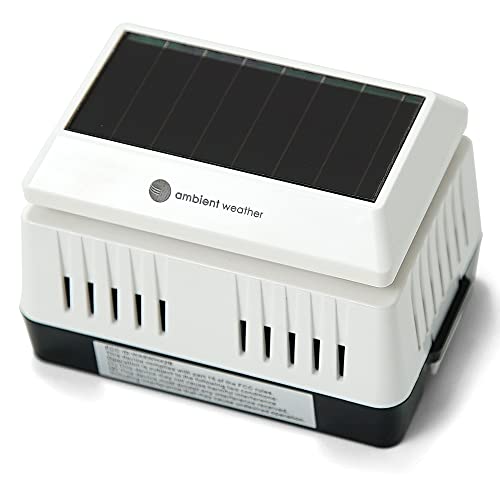
Ambient Weather PM2.5 Wireless Outdoor Particulate Monitor : Patio, Lawn & Garden
View on AmazonAcoustic and Camera Networks
- Camera traps for species presence, abundance proxies, and human activity (poaching, logging trucks).
- Acoustic arrays for biodiversity (birdsong, frogs, bats), gunshots, chainsaws, boats, and even glacial calving frequencies.
For a broader overview of how sensors and AI intersect across conservation, see How Technology Aids Conservation: Sensors, AI, and Renewable Solutions (/sustainability-policy/how-technology-aids-conservation-sensors-ai-renewables).
Core AI Techniques and Models
Different environmental signals call for different model families. The most common include:
Computer Vision (Imagery)
- Semantic segmentation (U‑Net, DeepLabV3+, SegFormer): Pixel-wise classification of land cover, water quality classes, burn severity.
- Object detection (YOLOv8, Faster/Mask R‑CNN): Logging roads, fishing vessels, wildlife, oil slicks, algal blooms as bounded regions.
- Change detection (Siamese nets, temporal CNNs): Deforestation, flooding, urban expansion using multi-date imagery.
- Plume retrievals (matched filtering, physics-informed CNNs): Methane and SO2 plume detection in hyperspectral/thermal imagery.
Time-Series Forecasting
- Classical: ARIMA, state-space models, Kalman filtering for sensor drift correction and gap-filling.
- Deep learning: LSTM/GRU, Temporal Convolutional Networks (TCN), Transformers for air pollution and hydrological forecasts.
- Hybrid/physics-informed: Embed dispersion or hydrodynamic constraints into learning objectives to maintain physical plausibility.
Anomaly Detection and Data Fusion
- Unsupervised: Isolation Forest, robust PCA, autoencoders for spotting rare events (e.g., sudden turbidity spikes, illegal emissions).
- Sensor fusion: Gaussian processes, kriging with external drift, gradient boosting, or deep fusion networks to combine satellites, ground monitors, and meteorology.
Transfer Learning and Self-Supervision
- Pretrained backbones (ResNet, EfficientNet, Vision Transformers) fine-tuned on remote sensing to cut labeled data needs by 50–90%.
- Self-supervised learning (e.g., masked autoencoders) leverages unlabeled satellite archives to improve performance under label scarcity.
Real-World Case Studies
Air Quality: Street-Level PM2.5 From Sparse Data
- Problem: Regulatory networks are too sparse for neighborhood maps; satellites see column AOD but not ground PM directly.
- Approach: Fuse TROPOMI/VIIRS aerosol optical depth, land use, traffic, and meteorology with scattered ground sensors via gradient boosting or spatiotemporal deep learning.
- Result: Multiple city-scale studies achieve R² of 0.7–0.9 for daily PM2.5 estimates at 1 km grids, enabling targeted interventions near schools and transit corridors (EPA- and NASA-supported research).
Water Quality: Early Warning for Harmful Algal Blooms (HABs)
- Problem: HABs force costly closures of beaches and intakes; boat sampling is late and sparse.
- Approach: Sentinel‑2 reflectance with in-situ chlorophyll-a and phycocyanin measurements, trained with U‑Net or gradient boosting; include weather and runoff proxies.
- Result: Operational pilots deliver 3–7 day lead times with high recall of bloom onset; utilities optimize treatment dosing and reduce service disruptions (NOAA/US EPA HAB programs).
Deforestation: Near-Real-Time Alerts
- Problem: Clearing can occur and spread before patrols respond.
- Approach: SAR+optical change detection models on Sentinel‑1/2; cloud services push weekly alerts to rangers.
- Result: GLAD-style alerts and Planet imagery have cut response times from months to days in parts of the Amazon and Congo Basin (WRI/academic evaluations). Agencies report higher interdiction rates and deterrence effects.
Wildlife Monitoring: From Camera Traps to Acoustic Indices
- Problem: Millions of images and audio hours overwhelm analysts; delays reduce conservation impact.
- Approach: Camera-trap pipelines using MegaDetector for human/animal filtering, species classifiers fine-tuned per region; acoustic models like BirdNET for species presence.
- Result: 80–95% reduction in manual review time and faster detection of poaching risk. For implementation guidance, see AI for Wildlife Monitoring: Technologies, Data Needs, and Practical Conservation Applications (/sustainability-policy/ai-for-wildlife-monitoring-technologies-data-needs-practical-conservation).
Emissions Detection: Methane Plumes and Hotspots
- Problem: Methane is 28–34x more potent than CO2 over 100 years; super-emitters drive a large share of emissions (IPCC/IEA).
- Approach: Satellite spectrometers (Sentinel‑5P, PRISMA) and dedicated missions (e.g., MethaneSAT, Carbon Mapper) with matched filtering and CNNs to detect and quantify plumes.
- Result: Publicly reported super-emitter events now trigger rapid operator response and regulatory scrutiny; IEA reports expanding satellite coverage is improving global inventories.
For habitat-focused deployments and governance issues, see Using AI for Habitat Conservation: Practical Applications, Data Needs, and Ethical Implementation (/sustainability-policy/using-ai-for-habitat-conservation-applications-data-ethics).
How to Build an AI Environmental Monitoring Project
1) Define Objectives and KPIs
- Decision first: enforcement alerts, planning maps, public dashboards, or compliance evidence.
- Metrics: precision/recall for events; RMSE/MAE for continuous variables; spatial IoU for segmentation; time-to-detection for operations.
- Governance: data-sharing agreements, consent policies, and standard operating procedures (SOPs) for responding to alerts.
2) Data Pipeline and Storage
- Ingest: Pull satellite imagery via STAC catalogs (e.g., Copernicus, Landsat) and APIs for ground sensors (e.g., OpenAQ, Water Quality Portal).
- Preprocess: Atmospheric correction, cloud/snow masking, BRDF normalization; resample to common grids.
- Organize: Cloud-Optimized GeoTIFF (COG), Parquet for tabular; spatial indexing; catalog with STAC metadata.
- Stream: Use Kafka/Kinesis/Pub/Sub for real-time sensors; buffer into time windows for model inference.
3) Feature Engineering
- Spectral indices: NDVI/EVI for vegetation, NDWI for water, turbidity proxies (red/NIR ratios), burn indices (NBR), built-up indices (NDBI).
- Spatial context: Terrain (slope, aspect), distance to roads/rivers, night lights (VIIRS), land use.
- Meteorology: Temperature, humidity, wind, boundary-layer height for air models.
- Sensor QC: Drift correction, calibration to reference stations, outlier handling.
4) Labeling and Training Data
- Sources: Regulatory datasets (EPA AQS), field campaigns, expert annotation in QGIS/Label Studio, community science (with validation).
- Splits: Spatial and temporal block cross-validation to avoid leakage; hold out geographies and years.
- Imbalance: Focal loss, class weighting, oversampling rare events (e.g., illegal burns).
- Uncertainty: Quantile regression, ensembles, or Bayesian layers; output confidence bands with maps.
5) Model Selection and Training
- Baselines: Random forest/XGBoost for tabular fusion often rival deep nets in accuracy and interpretability.
- Deep learning: U‑Nets/Transformers for imagery; LSTM/TCN/Temporal Fusion Transformers for forecasts.
- Physics-informed: Constrain outputs with dispersion/hydrology to reduce physically impossible predictions.
- Efficiency: Mixed precision, tiling, and data augmentation; use transfer learning to reduce data needs and energy use.
6) Validation and Field Testing
- Accuracy: Report precision/recall/IoU with confidence intervals; evaluate across seasons and land covers.
- Robustness: Test under clouds, sensor outages, and extreme events; simulate false positives and escalation workflows.
- Human-in-the-loop: Route low-confidence detections to expert review.
7) Deployment and MLOps
- Cloud: AWS SageMaker, GCP Vertex AI, or Azure ML for training/inference; orchestrate with Airflow/Prefect.
- Edge: NVIDIA Jetson/Orin or Google Coral for on-site camera/acoustic inference with intermittent connectivity.
- Serving: REST/gRPC APIs; tile servers for web maps; vector tiles for lightweight clients.
- Monitoring: Drift detection, data quality checks, automated retraining schedules.

NVIDIA Jetson Orin Nano Super Developer Kit : Electronics
View on Amazon8) Indicative Costs (order-of-magnitude)
- Cloud storage: $20–25 per TB-month (object storage, standard class); use COGs and lifecycle policies to cut 40–70%.
- GPU training: $10–35 per GPU-hour on major clouds depending on hardware and pricing model; many vision models train in 50–300 GPU-hours with transfer learning.
- Inference: $0.10–$0.50 per 1,000 images on CPUs at scale; edge devices $100–$1,000 each upfront.
- Sensors: Low-cost PM2.5 nodes $150–$300; multi-parameter water sondes $2,000–$10,000; mid-range drones with multispectral $3,000–$10,000.
- Teams: A lean pilot often succeeds with 3–5 people (data engineer, ML engineer, domain scientist, GIS analyst, PM).
For program design that integrates tech with policy and field operations, see Using Technology for Environmental Protection: Tools, Impacts, and Practical Guidance (/sustainability-policy/using-technology-for-environmental-protection-tools-impacts-practical-guidance).
Challenges, Limitations, and Ethics
- Data gaps and bias: High-quality labels often cluster near cities or roads; models overfit to well-observed areas. Use stratified sampling and active learning to improve coverage.
- Ground truth scarcity: Many water or biodiversity metrics lack gold standards; quantify uncertainty and avoid over-claiming.
- False positives/negatives: Enforcement actions based solely on AI can be harmful. Require human verification for sensitive outcomes.
- Privacy and consent: Camera and acoustic systems can capture people and speech. Apply on-device redaction, geofencing, retention limits, and clear signage. Observe GDPR/CCPA and local regulations.
- Indigenous and community data rights: Follow Free, Prior and Informed Consent (FPIC). Co-design projects and share benefits.
- Energy footprint: Training large models consumes significant electricity. Prefer transfer learning, measure emissions (e.g., CodeCarbon), and run in regions with cleaner grids.
- Regulatory context: The EU AI Act emphasizes transparency and risk management; environmental monitoring is generally low risk but may intersect with high-risk categories if used for law enforcement decisions. Methane and deforestation regulations (EU Methane Regulation, EUDR) raise expectations for traceable, auditable methods.
Tools, Platforms, and Open Datasets
Open-Source Libraries and Models
- Geospatial: Rasterio, GDAL, xarray, GeoPandas, STAC tooling (pystac, stac-fastapi).
- ML/DL: Scikit-learn, XGBoost, LightGBM, PyTorch, TensorFlow/Keras, PyTorch Lightning.
- Vision models: U‑Net/UNet++ (segmentation), DeepLabV3+, SegFormer, YOLOv8/YOLOv10, Mask R‑CNN.
- Acoustic/Bioacoustics: BirdNET, OpenSoundscape, Raven (analysis software), YAMNet for general audio embeddings.
- MLOps: MLflow, Weights & Biases, DVC, Prefect/Airflow, Great Expectations for data quality.
Cloud and GeoAI Platforms
- Google Earth Engine (and Earth Engine in Vertex AI) for planetary-scale preprocessing and classical ML.
- Microsoft Planetary Computer for STAC-accessible datasets and Azure compute.
- AWS Open Data (Landsat, Sentinel), SageMaker for training/hosting; Batch/Step Functions for pipelines.
- Esri ArcGIS GeoAI tools for integrated GIS + deep learning workflows.
- Edge AI: NVIDIA Jetson/DeepStream, Coral Edge TPU for low-power inference.
Public Datasets and APIs
- Land/Imagery: Landsat Collection 2, Sentinel‑1/2/5P, MODIS, VIIRS, Harmonized Landsat-Sentinel (HLS), Planet NICFI (tropical, via program access).
- Atmosphere: Sentinel‑5P TROPOMI (NO2, SO2, CH4), Copernicus Atmosphere Monitoring Service (CAMS), OpenAQ, EPA AirNow/AQS.
- Water: USGS NWIS and EPA Water Quality Portal, Copernicus Marine Service, NOAA HAB bulletins.
- Biodiversity: Wildlife Insights (camera-trap), GBIF occurrence data, Xeno‑canto/BirdNET datasets, Rainforest Connection (acoustic initiatives).
- Hazards: NASA FIRMS active fire, Global Flood Monitoring, Global Forest Watch GLAD alerts and tree cover loss.
For cross-cutting conservation AI methods and pitfalls, see How AI Is Used in Conservation: Technologies, Real-World Uses, and Key Challenges (/sustainability-policy/how-ai-is-used-in-conservation-technologies-applications-challenges).
Future Trends and How to Get Started
What’s Coming Next
- Edge AI and TinyML: More on-device inference for cameras and sensors, reducing bandwidth, latency, and privacy risks.
- Hyperspectral at scale: New satellites (e.g., Carbon Mapper, MethaneSAT) plus emerging commercial fleets will sharpen source attribution and quantify emissions with higher confidence.
- Foundation models for Earth observation: Large pre-trained models (e.g., masked autoencoders and vision transformers adapted to EO) promise rapid fine-tuning for local tasks with few labels.
- Federated and privacy-preserving learning: Train across jurisdictions or agencies without centralizing sensitive data.
- Physics-ML fusion: Tighter coupling of simulators (dispersion, hydrology, ecology) with neural nets for trustworthy predictions under climate extremes.
- Policy integration: Methane and deforestation regulations, plus urban clean-air plans, are creating sustained demand for verifiable, open methodologies and auditable uncertainty.
First Steps for Practitioners
- Start with the decision: Define what action a model output will trigger and who acts on it.
- Choose one flagship sensor pair: e.g., Sentinel‑2 + low-cost air sensors, or Sentinel‑1 SAR + patrol reports, to keep scope manageable.
- Build a minimum viable pipeline: STAC-based ingestion, a baseline model (random forest), and a simple dashboard with uncertainty bands.
- Validate with field partners: Co-design thresholds for alerts; test escalation workflows over 6–12 weeks.
- Plan for scale: Add multi-sensor fusion, edge devices where connectivity is poor, and MLOps for drift monitoring and retraining.
Environmental AI is no longer a pilot—it’s becoming public infrastructure. Teams that blend reliable sensors, transparent models, and accountable governance can generate real-world gains: cleaner air and water, intact forests, protected species, and verified emissions cuts.
Recommended Products
Deep Learning for the Earth Sciences: A Comprehensive Approach to Remote Sensing, Climate Science and Geosciences: Camps-Valls, Gustau, Tuia, Devis, Zhu, Xiao Xiang, Reichstein, Markus
by Gustau Camps-Valls (Editor), Devis Tuia (Editor), Xiao Xiang Zhu (Editor), Markus Reichstein (Editor) & 1 more
Ambient Weather PM2.5 Wireless Outdoor Particulate Monitor : Patio, Lawn & Garden
PM2.5 refers to particles that are 2.5 microns or smaller in diameter. <strong>Includes mounting screws, a solar collector, and rechargeable batteries</strong>. A USB port allows you to charge the bat
NVIDIA Jetson Orin Nano Super Developer Kit : Electronics
The NVIDIA Jetson Orin Nano Developer Kit <strong>sets a new standard for creating entry-level AI-powered robots, smart drones, and intelligent cameras</strong>,and simplifies getting started with the
More in AI & Technology
- AI for Wildlife Monitoring: Technologies, Data Needs, and Practical Conservation Applications
- How AI Is Used in Conservation: Technologies, Real-World Uses, and Key Challenges
- AI in Renewable Energy: Use Cases, Measurable Impacts, and How to Deploy
- Using AI for Habitat Conservation: Practical Applications, Data Needs, and Ethical Implementation