AI for Wildlife Monitoring: Technologies, Data Needs, and Practical Conservation Applications
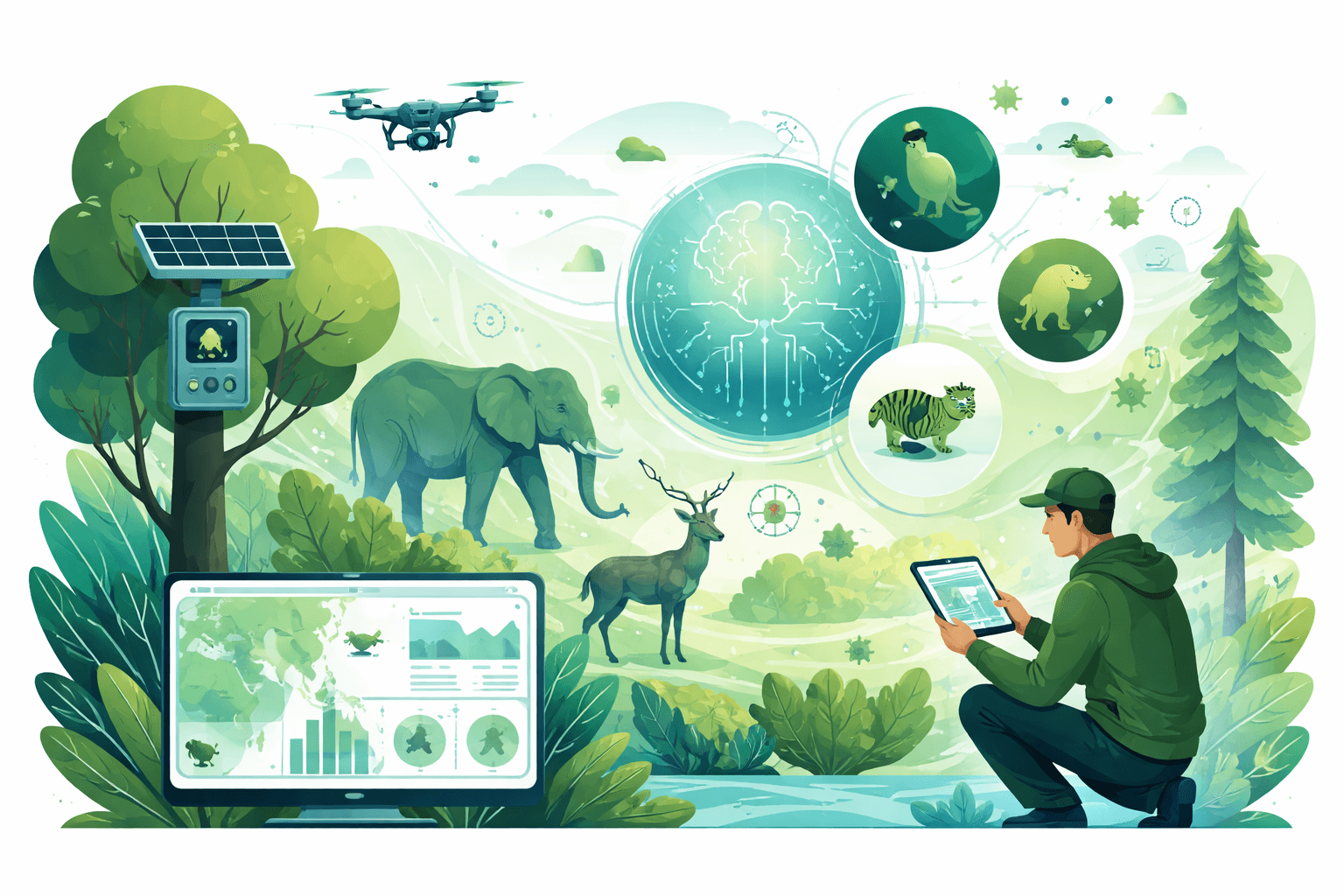
AI for wildlife monitoring is moving from pilots to practice. Conservation International’s Wildlife Insights now hosts over 100 million camera-trap images, with automated models pre-sorting and labeling much of that volume. In a landmark study on Snapshot Serengeti data, deep learning reached 92% species-identification accuracy and reliably counted individuals in images (Norouzzadeh et al., PNAS 2018). And Microsoft’s open-source MegaDetector has cut manual review workloads by 75–90% for many projects by filtering empty images and flagging humans and vehicles (Microsoft AI for Earth). These gains translate into faster population estimates, earlier threat detection, and more time for rangers and biologists to act.
This guide explains the core technologies behind AI for wildlife monitoring, shows where they deliver measurable conservation outcomes, details the data and model requirements to get robust results, and outlines deployment and ethical considerations. For a broader overview of AI’s role across conservation, see How AI Is Used in Conservation: Technologies, Real-World Uses, and Key Challenges (/sustainability-policy/how-ai-is-used-in-conservation-technologies-applications-challenges).
By the numbers
- 100M+ camera-trap images: Wildlife Insights platform scale (Conservation International)
- 92% species ID accuracy on camera-trap images with deep learning; near 99% top-5 accuracy (PNAS 2018, Snapshot Serengeti)
- 75–90% reduction in manual review time using MegaDetector for pre-filtering (Microsoft AI for Earth)
- 43–96% higher accuracy counting seabirds from drone imagery vs ground counts (Hodgson et al., Methods in Ecology and Evolution 2018)
- Near-real-time forest loss alerts (weekly to sub-weekly) from GLAD-powered Global Forest Watch (University of Maryland/World Resources Institute)
- A single autonomous recorder logging 24/7 can produce ~2,160 hours of audio in 90 days—requiring automated acoustic analysis to be tractable
AI for Wildlife Monitoring: Key technologies
Computer vision (images and video)
What it does: Detects species, counts individuals, identifies behaviors (e.g., feeding, vigilance), and flags anomalies in camera-trap, drone, and thermal footage.

Bushnell CelluCORE 20 Trail Camera for AT&T with Low Glow/80ft Night Range and HD Video Trail Camera
View on AmazonHow it works:
- Object detection models (e.g., YOLO, Faster R-CNN) draw bounding boxes around animals/humans/vehicles.
- Classification models assign species labels to full images or detected crops.
- Pose estimation and action recognition can infer behaviors and life-history events (e.g., nest attendance, courtship).
Why it matters: Camera traps routinely produce 10,000 to millions of images per project. Automated empty-image filtering and human/vehicle detection triage content for quick review, while species classifiers turn raw media into structured presence, count, and time-of-detection data suitable for occupancy and abundance models.
Evidence: On Snapshot Serengeti, deep learning achieved 92% species-level accuracy and could estimate group sizes with low error (Norouzzadeh et al., PNAS 2018). MegaDetector has become a de facto pre-processing step in multi-institutional workflows, reducing curation time by most of an order of magnitude (Microsoft AI for Earth).
Acoustic monitoring and audio event detection
What it does: Identifies species from vocalizations (birds, bats, frogs, whales), detects threats like chainsaws and gunshots, and measures soundscapes to infer biodiversity trends.
How it works:
- Spectrogram-based convolutional neural networks classify calls and songs in fixed windows or streaming audio.
- Event detectors locate and timestamp specific acoustic signatures (e.g., gunshots), triggering alerts.
- Soundscape indices and unsupervised models track community-level changes without species-level labels.
Why it matters: Autonomous recorders run continuously, especially useful where visibility is poor and for nocturnal or cryptic species. Real-time acoustic alerting can cue patrols quickly, while long-term archives support trend analysis.
Evidence: Bird acoustic classifiers and bat detectors now routinely reach high precision/recall for common species in well-sampled regions in benchmark tests; specialized detectors for anthropogenic sounds (chainsaws, gunshots) achieve high area-under-curve (AUC) scores in controlled evaluations and are used operationally by NGOs for rapid response. Platform adoption by conservation groups (e.g., Wildlife Acoustics, Arbimon, OpenEcoacoustics) underscores real-world utility.
Machine learning classification and anomaly detection
- Supervised classification maps inputs (images, audio snippets) to species or event labels.
- Semi/self-supervised learning leverages large unlabeled corpora to pre-train representations, reducing labeled-data needs and improving cross-site generalization.
- Anomaly detection highlights unusual patterns—rare species, novel behaviors, or unexpected human activity—by learning “normal” baselines.
Sensor fusion
Combining modalities—camera traps plus acoustic recorders, drones plus thermal cameras, or ground sensors plus satellite/RADAR—improves detectability and reduces false negatives. For example, thermal drones detect warm-bodied animals under low light, while high-resolution RGB imagery supports species ID; fusing both stabilizes counts. Similarly, pairing acoustic gunshot detection with camera traps along trails can verify events and support response.
Practical conservation use cases and measurable outcomes
Population surveys and occupancy/abundance estimation
- Camera-trap AI pipelines convert raw images into detection histories for occupancy models, enabling faster, broader surveys across landscapes. Projects using MegaDetector and species classifiers have reported multi-fold speedups from data collection to analyzed results.
- Drone-based counts: In seabird colonies, drone imagery classified by computer vision yielded 43–96% higher accuracy than ground counts (Hodgson et al., 2018). Similar workflows are used for pinnipeds, ungulates, and large herbivores.
- Acoustic indices and species-level classifiers generate continuous presence data for birds, amphibians, bats, and cetaceans—filling temporal gaps in visual surveys and capturing nocturnal activity.

Occupancy Estimation and Modeling: Inferring Patterns and Dynamics of Species Occurrence
Amazon.com: Occupancy Estimation and Modeling: <strong>Inferring Patterns and Dynamics of Species Occurrence</strong>: 9780120887668: MacKenzie, Darryl I., Nichols, James D., Royle, J. Andrew, Pollock
Check Price on AmazonMeasured impacts:
- Larger spatial/temporal coverage with the same staff and budget.
- Faster turnaround from field to insights (weeks instead of months), supporting adaptive management cycles.
Poaching and threat detection
- Human/vehicle detection in camera-trap streams near access points or protected zones flags potential incursions for ranger follow-up.
- Acoustic event detection identifies chainsaws and gunshots, enabling rapid deployment of patrols.
- Thermal drones with onboard detection can locate people and wildlife at night with greater safety.

DJI Mavic 3 Enterprise Thermal Advanced Drone Bundle : Toys & Games
View on AmazonMeasured impacts:
- Earlier alerts and triage reduce ranger response times; field programs report more interdictions and deterrence when high-risk periods and hotspots are identified. AI assists but does not replace intelligence-led patrol planning and community engagement.
Habitat change monitoring
- Satellite imagery with deep learning detects land-cover change (deforestation, wetland loss, mining expansion). GLAD alerts from the University of Maryland, used in Global Forest Watch, provide near-real-time loss at 30 m resolution, allowing monitoring teams to investigate quickly.
- Combining ground sensors with remote sensing ties species detections to habitat dynamics, improving causal inference.
Measured impacts:
- Rapid identification of encroachment informs targeted patrols and legal actions.
- Linking occupancy to habitat change supports prioritization of restoration and protection efforts. For practical habitat strategies, see Protecting Wildlife Habitats: A Practical Guide (/sustainability-policy/protecting-wildlife-habitats-guide-conservation-technology-action).
Human–wildlife conflict mitigation
- Real-time detection of elephants, big cats, or bears near farms or villages via camera traps, radar, or acoustic cues can trigger lights, alarms, or community alerts.
- Models trained on local species and typical approach routes reduce false alarms and fatigue.
Measured impacts:
- Reduced crop damage and retaliatory killings when alerts are timely and paired with community-led deterrents and response protocols.
Invasive species tracking
- Computer vision identifies invasive mammals (e.g., feral pigs), plants (early-stage incursions in high-res imagery), or aquatic species from underwater video.
- Acoustic monitoring detects invasive frogs or birds by distinctive calls.
Measured impacts:
- Earlier detection at low densities increases eradication success and reduces long-term costs.
For complementary field methods and how AI augments, not replaces, them, see Wildlife Conservation Methods: Practical Approaches, Tech Tools, and How to Measure Success (/sustainability-policy/wildlife-conservation-methods-practical-approaches-tech-tools-measure-success) and Effective Wildlife Conservation Practices (/sustainability-policy/effective-wildlife-conservation-practices-guide).
Data and model requirements: what it takes to build robust systems
Data types and volumes
- Images/video: Camera-trap projects typically accumulate 50,000 to millions of images. For species classification, hundreds to thousands of labeled images per species are ideal; rare species will have fewer examples and benefit from transfer learning and data augmentation.
- Audio: Species-level models often need tens to hundreds of minutes of annotated calls per species, with coverage across seasons, times of day, and habitats. Threat detectors (chainsaws, gunshots) require diverse negative samples to minimize false alarms.
Annotation strategies
- Start with triage: Use a general detector (e.g., “animal/human/vehicle/empty”) to pre-filter. Manually label a stratified sample across sites, seasons, and lighting conditions.
- Use hierarchical labels: Family/genus/species to enable fallback when species-level certainty is low.
- Adopt consistent conventions for bounding boxes, counts, and behaviors. Document labeler guidelines.
- Leverage citizen science with quality control: Consensus labeling and expert review on edge cases.
Transfer learning and domain adaptation
- Fine-tune from broadly trained backbones (e.g., ImageNet, large bioacoustic models) to reduce labeled-data needs.
- Domain adaptation: Train with multi-site data and augmentations (illumination, motion blur, background noise) to improve generalization to new locations.
Handling class imbalance
- Techniques: Weighted loss functions, focal loss, minority-class oversampling, targeted data augmentation, and active learning that prioritizes uncertain/rare examples for labeling.
- Consider event-level metrics (per-species precision/recall) rather than overall accuracy to avoid performance being dominated by common species or empty images.
Evaluation metrics that matter
- Detection: Average precision (AP), mean average precision (mAP) at relevant IoU thresholds; precision-recall curves.
- Classification: Per-class precision, recall, F1; top-k accuracy; calibration error if using confidence thresholds.
- Counting: Mean absolute error or root mean squared error between predicted and true counts.
- End-to-end: Time saved vs human-only workflows; false alarm rate per device per day for alerting systems.
- Cross-site validation: Hold out entire locations or seasons to test generalization.
Bias mitigation and data governance
- Site bias: Ensure training data covers different habitats, seasons, and camera placements to avoid overfitting to backgrounds.
- Species bias: Balance efforts so that rare and cryptic species are not systematically missed; report per-species performance.
- Human images: Implement automatic blurring and strict access controls; treat human detections as sensitive data.
- Dataset documentation: Maintain model cards and data sheets detailing provenance, permits, and known limitations. For building evidence-driven programs, see Beyond Intentions: A Data‑Driven Analysis of the Impact of Conservation Efforts (/conservation/beyond-intentions-impact-of-conservation-efforts).
Actionable recommendations for datasets
- Start small, iterate fast: Label 5–10k diverse images and 5–10 hours of audio to train a baseline; use active learning to expand efficiently.
- Prioritize edge cases: Night images, backlit subjects, partial occlusions, distant calls—these often drive field performance.
- Version everything: Keep immutable snapshots of data, labels, and models for reproducibility.
- Share when safe: Contribute to open repositories (e.g., LILA BC for camera traps) to accelerate the field, while redacting sensitive location metadata.
Deployment and operations: from model to field impact
Hardware choices
- Camera traps: Off-the-shelf models with motion triggers; consider cellular-enabled options for near-real-time uploads. For video, ensure sufficient write speed and storage.
- Acoustic recorders: Low-power devices (e.g., AudioMoth-class) for large arrays; higher-spec units where extended bandwidth or duty-cycling control is needed.
- Drones: RGB and thermal payloads for counts and nocturnal surveys; abide by aviation and wildlife disturbance rules.
Power and connectivity
- Power: Lithium AA or Li-ion packs for camera traps; solar trickle charging where feasible. Acoustic recorders often run weeks to months on batteries; solar can extend deployments.
- Connectivity: Options include cellular (3G/4G/LTE), LoRaWAN for short payloads, mesh relays, and satellite for remote sites. Design for intermittent uploads and store-and-forward.
Edge vs cloud inference
- Edge AI: On-device processing yields low latency (seconds), lower data-transfer costs, and immediate alerts; constrained by compute and power.
- Cloud AI: Centralized training and batch inference on higher-fidelity models; higher bandwidth needs and latency (minutes to hours). Hybrid approaches are common: run a lightweight detector at the edge and confirm species in the cloud.
Latency, cost, and maintenance
- Latency targets: Threat alerts in seconds to minutes; survey analytics within days to weeks post-deployment.
- Costs (typical ranges, project-dependent):
- Camera traps: $100–$600 per unit; cellular variants and external power add costs.
- Acoustic recorders: ~$60–$500+ per unit depending on features; microphones are consumables in harsh environments.
- Drones: $1,500–$15,000+ with sensors; regulatory compliance and pilot training add costs.
- Data: Cellular/satellite fees; cloud storage/compute; annotation labor (in-house or contracted).
- Maintenance: Plan service intervals for battery swaps, storage retrieval, sensor cleaning, and firmware updates; design mounts to reduce false triggers and wind noise.
Integrating AI into existing monitoring programs
- Co-design with field teams: Define questions first (species of concern, indicators, response thresholds) and map them to sensor and model choices.
- Start with triage: Use generic detectors to realize immediate time savings; add species-level models where they unlock new decisions.
- Build SOPs: Who reviews alerts? What constitutes a verified event? What is the escalation path? Log outcomes to assess impact.
- Train the trainers: Upskill rangers and technicians to manage devices, interpret outputs, and report anomalies.
- Monitor and adapt: Track false alarms, missed detections, and maintenance burdens; update models seasonally or annually with new data.
Ethical, legal, and community factors
Privacy and safety
- Human detections: Cameras and recorders may capture people incidentally. Implement automatic blurring, strict access controls, and clear data-retention limits. Align with applicable privacy laws (e.g., GDPR-like standards) and protected-area regulations.
- Sensitive species and locations: Do not publish precise coordinates or time-stamped detections that could facilitate poaching. Use geoprivacy and data redaction.
Local stakeholder engagement
- Free, prior, and informed consent (FPIC): Engage Indigenous Peoples and local communities before deploying sensors; explain objectives, data flows, and benefits.
- Co-benefits: Share results with communities, involve local monitors, and ensure alerting systems support their priorities (e.g., crop protection, human safety). For community-led models and lessons, see Community Conservation 2023: Impact, Innovation, and Lessons for Scale (/conservation/community-conservation-2023-impact-innovation-lessons-scale).
Data governance and compliance
- Permits: Verify research, wildlife, and aviation permits; many jurisdictions regulate acoustics and camera placement in protected areas.
- Governance: Establish data ownership, access rights, and sharing policies upfront. Use data-sharing agreements for multi-organization collaborations.
- Open vs proprietary: Prefer open models and datasets where safe to do so to foster transparency and reproducibility; keep sensitive subsets restricted.
Limitations to set expectations
- Domain shift: Models trained in one region may underperform elsewhere due to different backgrounds, species morphs, or acoustic environments; plan for local fine-tuning.
- Rare species: Low training data and low base rates mean higher uncertainty; treat detections as hypotheses to be verified.
- False alarms vs misses: Optimize thresholds for your use case; threat detection may accept more false positives to avoid missing critical events, while long-term monitoring may prioritize precision.
- Maintenance reality: Harsh environments degrade sensors; budget for replacements and spares.
Near-term trends shaping the field
- Foundation models for ecology: Self-supervised pretraining on millions of wildlife images and years of audio will improve few-shot species recognition and cross-site robustness.
- Multimodal fusion: Joint vision–audio models and integration with satellite/RADAR will enhance detectability and context awareness.
- On-device AI: More capable, lower-power chips will bring species-level inference to the edge, reducing latency and connectivity costs.
- Probabilistic workflows: Better uncertainty estimation and occupancy modeling integrations will turn per-frame predictions into defensible population metrics.
- eDNA meets AI: Machine learning on genomic reads will refine species presence estimates and complement camera/acoustic data.
What this means for practitioners
- For managers: Expect faster, broader surveys and earlier threat detection—but pair AI with clear SOPs, legal compliance, and community engagement.
- For data teams: Invest in diverse, well-documented datasets; measure per-species performance; validate across sites; and iterate with active learning.
- For funders: Support hardware plus long-term maintenance, annotation labor, and model updates—the full lifecycle is where impact is realized.
AI for wildlife monitoring is not a silver bullet, but the evidence shows it can multiply conservation capacity—transforming raw sensor data into timely, actionable intelligence when embedded in strong field programs and partnerships.
Recommended Products
Occupancy Estimation and Modeling: Inferring Patterns and Dynamics of Species Occurrence
Amazon.com: Occupancy Estimation and Modeling: <strong>Inferring Patterns and Dynamics of Species Occurrence</strong>: 9780120887668: MacKenzie, Darryl I., Nichols, James D., Royle, J. Andrew, Pollock
Bushnell CelluCORE 20 Trail Camera for AT&T with Low Glow/80ft Night Range and HD Video Trail Camera
Amazon.com : Bushnell CelluCORE 20 Trail Camera for AT&T with Low Glow/80ft Night Range and HD Video Trail Camera : Sports & Outdoors
DJI Mavic 3 Enterprise Thermal Advanced Drone Bundle : Toys & Games
The drone's wide equivalent focal ... of applications.The Mavic 3 Enterprise Thermal Drone is <strong>equipped with a 12MP zoom camera, supporting up to 56x max hybrid zoom</strong>, allowing you
More in Sustainability Policy
- Beyond the Algorithm: How AI Is Transforming — and Challenging — Wildlife Protection
- How AI Is Used in Conservation: Technologies, Real-World Uses, and Key Challenges
- AI for Environmental Monitoring: Methods, Use Cases & Tools
- Using AI for Habitat Conservation: Practical Applications, Data Needs, and Ethical Implementation