Using AI for Habitat Conservation: Practical Applications, Data Needs, and Ethical Implementation
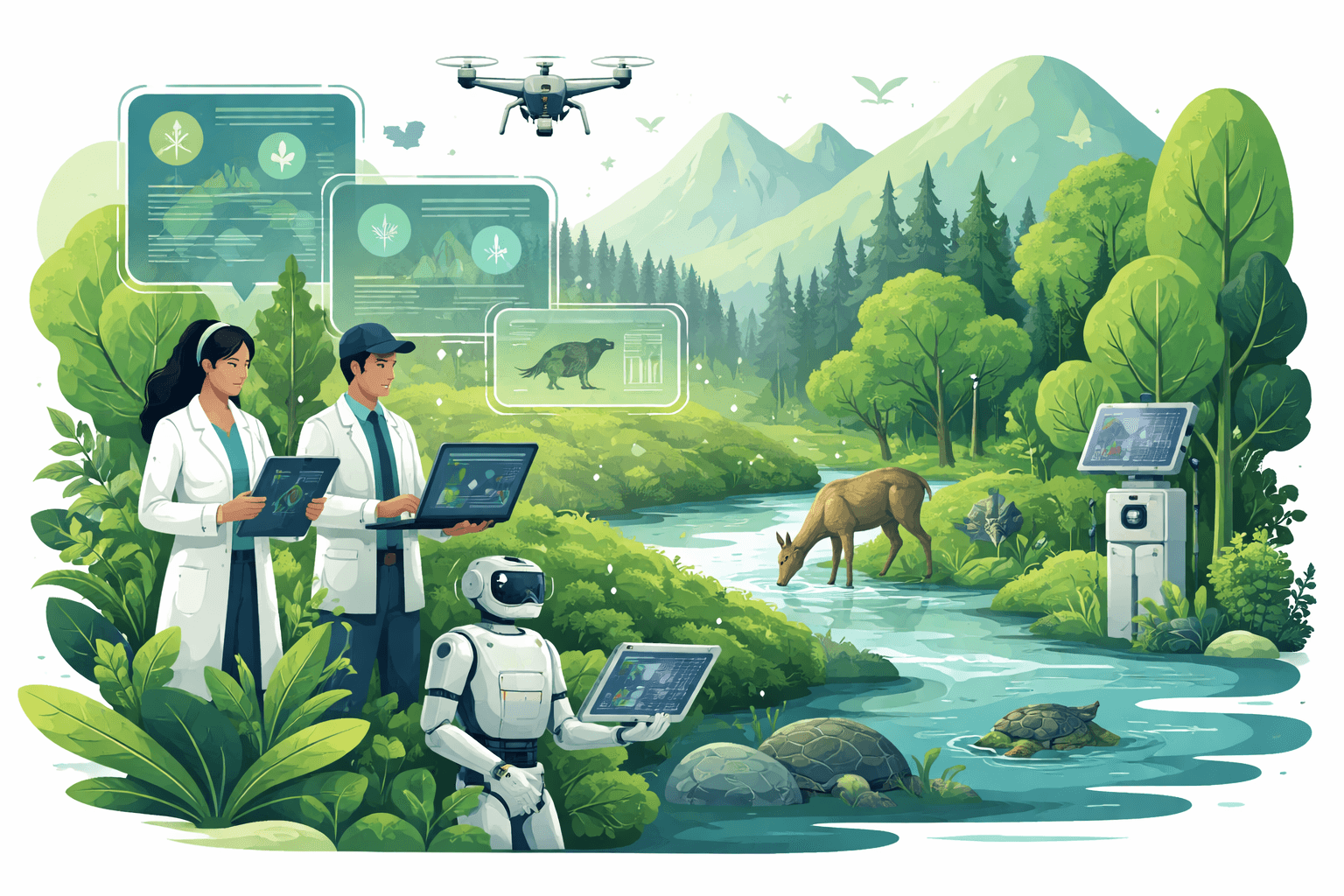
Habitat loss is accelerating: in 2023, the tropics lost an estimated 3.7 million hectares of primary forest, driving about 2.4 gigatons of CO2 emissions, according to Global Forest Watch and the University of Maryland. Against this backdrop, using AI for habitat conservation is moving from pilot to practice—processing millions of images and audio clips, predicting threats before they materialize, and guiding restoration dollars to where they protect the most biodiversity and resilience.
This guide distills where AI works today, the data you need, practical tools and deployment options, and how to govern projects so they deliver measurable ecological benefits and respect community rights.
Core applications of AI for habitat conservation
AI is not a silver bullet, but it is a force multiplier when paired with sound ecology, robust data, and on-the-ground stewardship.
Remote sensing and computer vision for habitat and species mapping
- Habitat classification and change detection. Convolutional neural networks (CNNs) and segmentation models such as U-Net can classify land cover (e.g., mangroves, peatlands, grasslands) from satellite and drone imagery and flag disturbances. Sentinel‑2 offers 10 m optical resolution with ~5‑day revisit; Landsat provides a 30 m, 50‑year archive—both free via NASA/USGS and Copernicus.
- Forest and peat degradation. Combining multispectral (Sentinel‑2) and radar (Sentinel‑1) data with machine learning improves detection under clouds and in dense canopies. Studies show radar backscatter features with random forests or gradient boosting can raise disturbance detection precision relative to optical-only baselines, especially in the humid tropics.
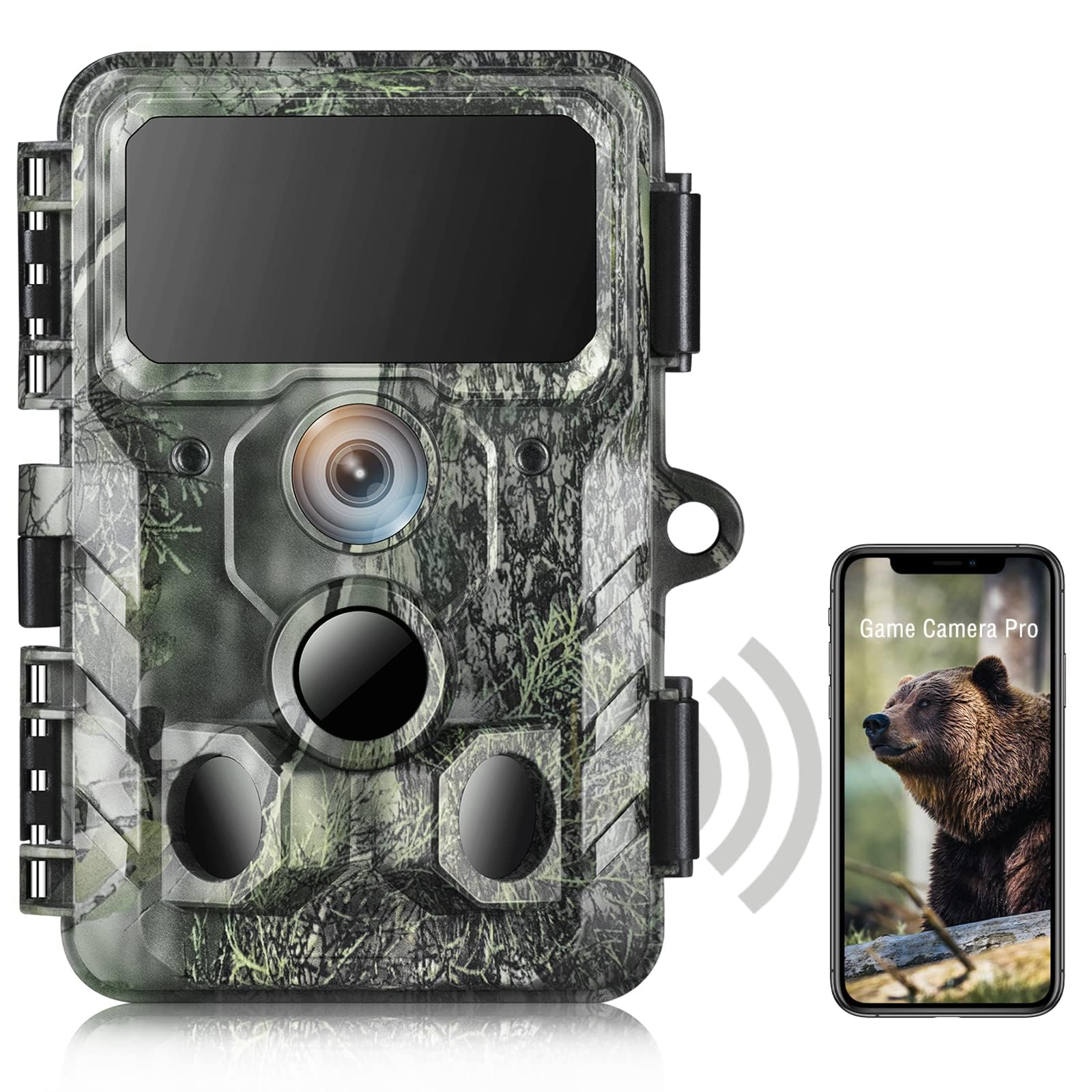
- Species detection from imagery. Object detectors (e.g., YOLOv8, Faster R‑CNN) trained on drone or camera‑trap images can locate large mammals, nesting seabirds, or canopy trees like Araucaria. Platforms such as Wildlife Insights report that AI now triages tens of millions of camera‑trap images and can auto‑identify many species with high precision, dramatically reducing human labeling time.
Bushnell Core DS-4K No Glow Trail Camera. Hunting ...
View on AmazonFor a deeper dive on AI-enabled monitoring workflows and field-tested tools, see our explainer on AI for Wildlife Monitoring: Technologies, Data Needs, and Practical Conservation Applications.
Bioacoustic monitoring
- Species presence and activity. Acoustic classifiers convert audio into spectrograms (images of sound) and use CNNs to detect calls from birds, bats, frogs, and insects. BirdNET, developed by the Cornell Lab of Ornithology and TU Chemnitz, supports identification for thousands of bird species and has processed millions of crowd-sourced recordings in recent years.
- Threat detection. Models trained to identify chainsaws, gunshots, or vehicle noise can trigger real-time alerts for rangers. Organizations like Rainforest Connection deploy solar-powered recorders streaming audio to cloud models for early warnings.
- Community-scale monitoring. Low-cost recorders and smartphone apps allow communities to collect continuous data at landscape scales, feeding standardized indices of biodiversity and soundscape health.
Predictive threat models
- Poaching risk forecasting. The PAWS (Protection Assistant for Wildlife Security) framework from researchers at USC/Harvard integrates patrol histories, terrain, and human-access features with machine learning and game theory to recommend patrol routes. Field deployments in Asia and Africa have reported increases in snare detections and patrol efficiency relative to status quo planning.
- Invasive species spread. Ensemble models (random forests, gradient boosting) combine climate, hydrology, and connectivity variables to predict establishment and spread of invaders such as water hyacinth or feral pigs, guiding rapid response.
- Climate exposure and refugia. Species distribution models (SDMs) enhanced with deep neural networks can incorporate complex, nonlinear responses to climate variables, identifying potential climate refugia and corridors for assisted migration.
Habitat Suitability and Distribution Models: With Applications in R (Ecology, Biodiversity and Conservation): Guisan, Antoine, Thuiller, Wilfried, Zimmermann, Niklaus E.
by Antoine Guisan (Author), Wilfried ... book <strong>introduces the key stages of niche-based habitat suitability model building, evaluation and prediction required for understanding and predicting f
Check Price on AmazonFor broader context on where AI adds value—and where it struggles—see How AI Is Used in Conservation: Technologies, Real-World Uses, and Key Challenges.
AI-driven restoration prioritization and optimization
- Site selection. Gradient boosting (e.g., XGBoost) and Bayesian optimization can rank degraded sites by expected biodiversity gains, carbon sequestration, erosion control, and proximity to seed sources—subject to budget and land tenure constraints.
- Species mixes and micro-siting. Reinforcement learning and spatial optimization can suggest tree species mixes and planting densities that maximize survival under projected drought stress or fire risk.
- Monitoring recovery. Computer vision tracks canopy closure, vegetation structure, and edge effects post-restoration, verifying outcomes and enabling adaptive management.
If you’re scoping a restoration program, our guide to Wildlife Habitat Restoration Projects: Goals, Techniques, and Measuring Long-Term Success covers baseline setting, indicators, and long-term maintenance that pair well with AI monitoring.
By the numbers
- 3.7 million hectares: Primary tropical forest loss in 2023, emitting ~2.4 Gt CO2 (WRI/Global Forest Watch; UMD)
2 billion: Species occurrence records in the Global Biodiversity Information Facility (GBIF), available for research and modeling
- ~10 m: Spatial resolution of Sentinel‑2 optical imagery; 10 m for Sentinel‑1 radar—both free and global
1.2 billion: Bird observations in eBird (Cornell Lab of Ornithology), a key training and validation source for avian models
- Minutes not months: Camera-trap AI now filters and labels images at scale on platforms like Wildlife Insights, accelerating analysis by orders of magnitude
Data requirements and sources for using AI for habitat conservation
High-performance models start with fit‑for‑purpose data and careful curation.
Core data types
- Satellite imagery. Landsat (30 m, 16‑day; archive since 1972), Sentinel‑2 MSI (10 m, ~5‑day), Sentinel‑1 SAR (10 m radar; all-weather), MODIS (250–500 m daily, for phenology and fire), commercial constellations (e.g., PlanetScope at 3–5 m; Maxar at <1 m) when budgets allow.
- Drone data. RGB and multispectral imagery at centimeter resolution for fine-scale mapping of wetlands, riparian buffers, and smallholder mosaics; LiDAR for canopy height and structure.
- Camera-trap imagery. Still images or short videos triggered by motion; essential for elusive mammals and ground-dwelling birds.
- Acoustic recordings. Continuous audio streams or scheduled recordings from autonomous units; ultrasound for bats; hydrophones for freshwater/marine habitats.
- Environmental sensors. Temperature, soil moisture, water quality (turbidity, dissolved oxygen), and microclimate loggers; flux towers for restoration carbon studies.
- Citizen science and lab data. eBird, iNaturalist, GBIF for occurrences; herbarium and museum collections; eDNA barcoding results and metabarcoding for occupancy.
Labeling, preprocessing, and quality control
- Annotation. Use tools like CVAT or Label Studio for bounding boxes, segmentation masks, and spectrogram labels. Establish clear taxonomic guidelines and handle look‑alike species with expert review.
- Metadata standards. Adopt Darwin Core for species occurrence data; record sensor make/model, deployment dates, coordinate reference systems, and privacy flags.
- Preprocessing. For imagery: atmospheric correction, cloud/shadow masking, and BRDF normalization; for audio: noise reduction and standard sampling rates; for tabular data: feature scaling and handling of class imbalance (e.g., focal loss, SMOTE with care).
- Spatial and temporal validation. Standard k‑fold cross‑validation can inflate accuracy when data are spatially autocorrelated. Use spatial block cross‑validation or leave‑one‑region‑out approaches (see Roberts et al., Methods in Ecology and Evolution, 2017) and hold out time periods to test generalization.
- Quality assurance. Track inter‑annotator agreement; run periodic gold‑standard checks; quantify uncertainty with calibration curves and prediction intervals.
Open datasets and sharing constraints
- Open sources. NASA Earthdata and Copernicus Open Access for satellite data; GBIF for occurrences; Macaulay Library and Xeno‑canto for bioacoustics; Wildlife Insights offers open datasets from some partners; Global Forest Watch for alerts and contextual layers.
- Sensitive data. Many species are threatened by collection or poaching; follow IUCN/GBIF guidance to generalize or mask coordinates, time‑shift timestamps, and implement data‑use agreements. Respect Free, Prior, and Informed Consent (FPIC) for community-owned data and ensure benefit sharing consistent with the Nagoya Protocol where genetic resources are involved.
Practical tools, models, and deployment pathways
Model families you’ll actually use
- CNNs for images and spectrograms. ResNet/EfficientNet backbones for classification; U‑Net/DeepLab for segmentation; Faster R‑CNN/YOLOv8 for object detection in drone and camera‑trap imagery.
- Gradient‑boosted trees. XGBoost/LightGBM excel on tabular ecological predictors for restoration prioritization, invasion risk, and SDMs with engineered features.
- Time‑series models. Temporal CNNs or LSTMs for phenology, fire risk, or hydroacoustic patterns; Hidden Markov Models for occupancy dynamics.
- Classical SDMs and hybrids. MaxEnt and GAMs remain strong baselines; ensemble with ML to capture nonlinearities while retaining interpretability.
Accessible toolkits and platforms
- Google Earth Engine (GEE). Planet‑scale raster processing, built‑in classifiers, and rich datasets—ideal for rapid prototyping of habitat maps and change detection.
- QGIS/ArcGIS with ML plugins. Bring ML into familiar GIS workflows.
- Wildlife Insights. Cloud platform for camera‑trap management, AI labeling, and data sharing.
- Arbimon and OpenSoundscape. Platforms and open-source libraries for bioacoustic analysis and model training.
- EarthRanger and SMART. Operational platforms for integrating model outputs (alerts, risk maps) into ranger patrols and incident reporting.
For field deployments that intersect security and community protection, see our feature on risks and safeguards in Beyond the Algorithm: How AI Is Transforming — and Challenging — Wildlife Protection.
Cloud vs. edge inference
- Cloud inference. Pros: heavy models, centralized updates, cross‑site learning, and integrated dashboards. Cons: connectivity requirements, latency for rapid response, recurring cloud costs.
- Edge inference. Running models on‑device—e.g., camera traps with on‑board detectors (TrailGuard‑style), Raspberry Pi + Coral TPU for audio—reduces bandwidth and speeds alerts. Budget for power (solar + batteries), ruggedization, and remote update mechanisms.
- Hybrid. Pre‑filter on the edge (e.g., detect “any chainsaw-like event”), then send short clips to the cloud for species- or event‑level classification.

Google Coral USB Edge TPU ML Accelerator coprocessor for Raspberry Pi and Other Embedded Single Board Computers : Electronics
View on AmazonLow-cost hardware and citizen-science integration
- Hardware. Raspberry Pi, NVIDIA Jetson Nano/Orin Nano for heavier models; ESP32 for simple acoustic triggers; low-power microphones; LoRaWAN or cellular for backhaul; solar trickle-charging.
- Citizen science. Smartphone apps (e.g., BirdNET, Merlin, iNaturalist) can collect labeled data at scale. Establish validation pipelines (expert review, consensus labeling) and feedback loops to improve models where volunteers are most active.
Governance, ethics, and impact measurement
Powerful models can create new risks if deployed without safeguards. Embedding governance from day one lowers those risks and improves outcomes.
Bias, fairness, and model reliability
- Geographic and taxonomic bias. Training data is often skewed toward accessible, well‑studied regions and charismatic species. Mitigate with targeted data collection in undersampled habitats and class‑balanced training. Track per‑species and per‑region performance, not just overall accuracy.
- Domain shift. Models trained in one ecoregion often degrade elsewhere due to different vegetation, soundscapes, or camera placement. Use domain adaptation, fine‑tuning with a small local dataset, and spatial cross‑validation.
- Explainability and thresholds. Favor interpretable features where possible (e.g., SHAP values for tabular models) and set conservative alert thresholds when false positives carry high operational costs.
Data privacy, indigenous rights, and consent
- Sensitive locations. Mask or generalize coordinates for threatened species; restrict access with tiered permissions and audit trails.
- Community data governance. Co‑design data collection with community representatives; document FPIC; clarify who owns raw data, models, and derived products; and define benefit-sharing and data-retention timelines in writing.
- Human subjects. Camera traps and drones can capture people inadvertently. Implement privacy-by-design: on‑device blurring of faces, strict retention limits, and compliance with applicable privacy laws.
Stakeholder engagement and capacity building
- Co-design objectives. Translate conservation goals (e.g., reduce illegal logging by 50% within 12 months) into measurable model targets and operational KPIs.
- Training and handover. Budget for ranger, community, and analyst training; create plain‑language SOPs; plan for staff turnover.
- Open knowledge. Where safe, publish code/models and contribute to shared datasets to accelerate learning across landscapes.
Monitoring, evaluation, and long-term costs
- Technical performance. Track precision, recall, F1, and calibration; report per‑class confusion matrices. For imbalanced problems (rare events), prefer precision‑recall AUC over ROC AUC.
- Conservation impact. Tie AI outputs to ecological outcomes: hectares of habitat protected or restored; changes in species occupancy or abundance; reduced illegal activity per patrol‑km; time‑to‑detect and time‑to‑respond; additionality compared to counterfactuals. Robust designs include before‑after control‑impact (BACI), difference‑in‑differences, or randomized patrol allocations where ethical and feasible.
- Cost and maintenance. Total cost of ownership includes sensors, connectivity, data labeling (e.g., 100,000 images at $0.05 each = $5,000), storage and compute, model updates, field maintenance, and governance overhead. Budget for replacement cycles and spare parts.
For evidence-focused frameworks to judge whether interventions actually work, see our analysis in Beyond Intentions: A Data‑Driven Analysis of the Impact of Conservation Efforts.
Implementation roadmap: from pilot to program
Define the conservation decision you need to improve. Examples: allocate patrols weekly, prioritize 10,000 ha for restoration, or detect mangrove clearing within 48 hours.
Inventory data and gaps. What imagery, audio, and occurrence data already exist? Where are the gaps, and what new sensors or partnerships are needed? Prioritize data that align with your decision cadence and spatial scale.
Start with a baseline and a strong, simple model. Establish non‑AI baselines (manual review, rules‑based alerts) and compare against a first‑pass model (e.g., gradient boosting on engineered features or transfer learning with a lightweight CNN).
Validate spatially and operationally. Hold out regions for testing; run side‑by‑side comparisons with rangers or restoration teams; track false alarms and missed events.
Plan deployment architecture. Choose cloud, edge, or hybrid based on latency, bandwidth, and power constraints. Establish secure update paths and data retention policies.
Govern and document. Privacy impact assessments, FPIC documentation, data dictionaries, and versioned model cards describing intended use, training data, and known limitations.
Iterate toward impact. Use error analysis and stakeholder feedback to refine sensors, labels, and thresholds. Refresh models on a schedule that matches environmental seasonality and sensor drift.
Where the field is heading
- Foundation models for Earth observation and ecoacoustics. Large vision and audio models pre‑trained on petabytes of unlabeled data can drastically reduce labeled data needs via fine‑tuning and in‑context learning for local species and habitats.
- Near-real-time habitat dashboards. Integration of GLAD/Sentinel‑2 change alerts, on‑device acoustic triggers, and patrol data into operational platforms will shorten the window from disturbance to response from weeks to hours.
- Coupled climate–biodiversity planning. Joint optimization frameworks will co‑prioritize sites for biodiversity, carbon permanence, water security, and community livelihoods under multiple climate scenarios.
- Trust and governance by default. Model cards, dataset statements, and community data agreements are becoming standard, improving transparency and long-term legitimacy.
Using AI for habitat conservation is maturing into a practical toolkit—if teams invest in data quality, fit-for-purpose models, and governance that centers people and measurable ecological outcomes. With rigorous design and sustained partnerships, these systems can help protect ecosystems at the speed and scale the moment demands.
Recommended Products
Habitat Suitability and Distribution Models: With Applications in R (Ecology, Biodiversity and Conservation): Guisan, Antoine, Thuiller, Wilfried, Zimmermann, Niklaus E.
by Antoine Guisan (Author), Wilfried ... book <strong>introduces the key stages of niche-based habitat suitability model building, evaluation and prediction required for understanding and predicting f
Bushnell Core DS-4K No Glow Trail Camera. Hunting ...
Browse Bushnell trail cameras with crystal-clear image quality and weather-resistant design. Perfect for scouting and property monitoring.
Google Coral USB Edge TPU ML Accelerator coprocessor for Raspberry Pi and Other Embedded Single Board Computers : Electronics
Specifications: Arm 32-bit Cortex-M0+ microprocessor (MCU): up to 32 MHz max 16 KB flash memory with ECC 2 KB RAM connections: USB 3.1 (Gen 1) port and cable (SuperSpeed, 5Gb/s transfer speed) Feature
More in Sustainability Policy
- How AI Is Used in Conservation: Technologies, Real-World Uses, and Key Challenges
- AI for Wildlife Monitoring: Technologies, Data Needs, and Practical Conservation Applications
- Beyond the Algorithm: How AI Is Transforming — and Challenging — Wildlife Protection
- How Technology Aids Conservation: Sensors, AI, and Renewable Solutions