How Technology Aids Conservation: Sensors, AI, and Renewable Solutions
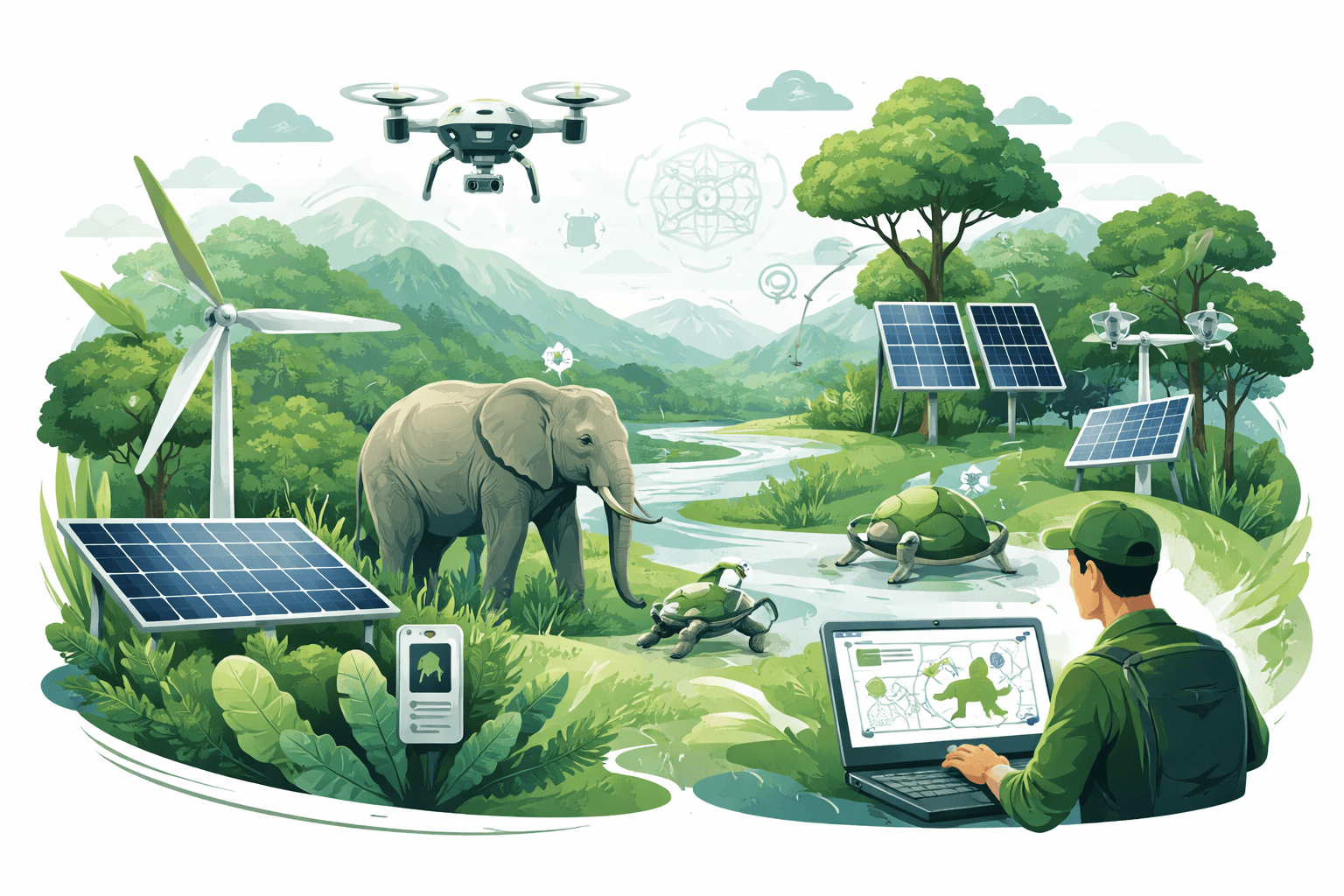
Satellites now image Earth at 10‑meter resolution every five days and radar can see through clouds; AI can flag a chainsaw or a gunshot in a rainforest audio stream within minutes; and solar‑powered sensors can run for years in remote parks. This is how technology aids conservation today—by shrinking detection times from months to days, turning scattered field notes into real‑time decision support, and lowering the energy footprint of protection and restoration. The stakes are high: the IPBES Global Assessment estimates around 1 million species face extinction risk and that humans have significantly altered over 75% of terrestrial environments. Technology cannot replace policy or local stewardship, but it is changing what’s possible in monitoring, enforcement, and recovery.
Remote sensing and aerial platforms
Earth observation has become conservation’s early‑warning system. Two families of satellites anchor the modern toolkit:

Remote Sensing for Ecology and Conservation: A Handbook of Techniques (Techniques in Ecology & Conservation): Horning, Ned, Robinson, Julie A., Sterling, Eleanor J., Turner, Woody, Spector, Sacha
This book <strong>describes the ways that remotely sensed data from research on biodiversity and its conservation can be captured and used, especially for evaluating human impacts on ecological system
Check Price on Amazon- Landsat (NASA/USGS), delivering 30‑meter imagery since 1972—critical for long‑term habitat change baselines.
- Sentinel‑2 (ESA), delivering 10‑meter multispectral imagery with ~5‑day revisit, allowing near‑real‑time tracking of land‑use change.
Where clouds block optical sensors, synthetic aperture radar (SAR) such as Sentinel‑1 (C‑band, ~10‑meter resolution, 6–12‑day revisit) penetrates cloud cover and some forest canopies, enabling continuous monitoring in the humid tropics. Global platforms like Global Forest Watch (led by WRI with University of Maryland GLAD alerts and partner radar alerts) use these streams to generate deforestation warnings within days, rather than the months typical of conventional reporting. National systems—such as Brazil’s INPE PRODES and DETER programs—demonstrate that frequent, public alerts support targeted enforcement and have historically been linked to reductions in forest loss when paired with policy and patrol capacity.
LiDAR, which uses laser pulses to map 3D structure, adds a vertical dimension that optical imagery cannot. NASA’s GEDI instrument has sampled billions of laser shots to estimate forest canopy height and above‑ground biomass between 51.6°N and 51.6°S, refining carbon accounting and identifying priority areas for restoration and protection. Airborne LiDAR over mangroves and peatlands reveals micro‑topography and hydrology critical to restoring water tables and mitigating fire risk.
Drones bridge the scale gap between satellites and boots on the ground. Multirotor platforms can produce 2–5‑centimeter orthomosaics of wetlands, coastlines, or forest edges and carry thermal cameras for nocturnal wildlife counts or anti‑poaching patrol support. Typical flights of 20–40 minutes cover 1–5 square kilometers per sortie; fixed‑wings extend range for coastal seabird colony surveys or post‑fire vegetation assessments. Example applications include:
- Mapping elephant trails and crop‑raiding hotspots to design low‑conflict corridors.
- Counting nesting sea turtles or seals with AI‑assisted object detection on drone imagery.
- Spot‑checking selective logging in community forests to verify compliance.
Limitations matter. Optical satellites struggle with clouds; radar requires specialized processing and can confuse floodplain dynamics with deforestation. Drones face airspace regulations, battery constraints, and potential disturbance to wildlife if protocols are not followed. Even so, the integration of optical, radar, and drone data—often fused in cloud platforms—now routinely turns imagery into patrol routes, restoration plans, and verified outcomes. For a deeper look at where remote sensing meets on‑the‑ground protection, see our guide on Using Technology for Environmental Protection: Tools, Impacts, and Practical Guidance (/sustainability-policy/using-technology-for-environmental-protection-tools-impacts-practical-guidance).
IoT and in‑field sensors
Conservation has moved from seasonal field campaigns to continuous sensing. Three classes of devices dominate: camera traps, acoustic monitors, and environmental/telemetry sensors.

RECONYX HyperFire 2 Covert IR Camera (OD Green)
View on AmazonCamera traps: Motion‑triggered stills or video, often with infrared flash, generate species occurrence data that feed occupancy models, activity patterns, and population indices. Global initiatives like Wildlife Insights have processed tens of millions of images using standardized metadata and AI pre‑screening, accelerating analyses that once took years. For elusive carnivores or ground birds, these networks are often the only systematic data available across large landscapes.
Acoustic monitors: Autonomous recorders sample soundscapes—detecting species‑specific calls (frogs, birds, bats, whales), threats (chainsaws, gunshots), and ecological “intactness” via acoustic indices. In tropical forests, systems inspired by the Rainforest Connection model have shown that chainsaw and vehicle signatures can be detected and relayed within minutes when connectivity exists, allowing rangers to respond while illegal activity is in progress. In marine settings, hydrophones feed whale‑presence alerts into ship speed advisories, reducing ship‑strike risk in key migration corridors (as reported by NOAA and academic partners in North America).
Environmental sensors and telemetry: Water‑quality sondes track dissolved oxygen and turbidity to prevent fish kills; soil moisture probes and microclimate loggers guide restoration irrigation; and GPS/Argos/Iridium collars and tags reveal migration routes, mortality clusters, and fence‑crossing points. Lightweight solar tags (<5 g) have opened new windows into songbird migrations, while low‑power LoRaWAN and mesh networks extend coverage in parks with no cellular service.
Real‑world constraints shape design choices. Duty cycling (sampling less frequently to save power), edge processing (filtering audio or images on‑device to avoid transmitting everything), and solar trickle charging extend deployments from weeks to months or years. Still, communications are often the bottleneck: in deep rainforest, cellular links may be absent; satellite modems add cost and energy draw; and line‑of‑sight for point‑to‑point radio can be blocked by terrain. Balancing detection performance, power budget, and data latency is the core engineering trade‑off for field IoT.
For practical field methods and metrics, including when to choose camera traps versus acoustic arrays, see AI for Wildlife Monitoring: Technologies, Data Needs, and Practical Conservation Applications (/sustainability-policy/ai-for-wildlife-monitoring-technologies-data-needs-practical-conservation).
AI and data analytics
AI is now the workhorse that turns raw data into usable intelligence. In conservation, three families of models are seeing wide use:
Automated identification: Convolutional neural networks classify species in camera‑trap images; spectrogram‑based models identify bird, bat, and frog calls; and object detectors count nests or individuals in drone imagery. Peer‑reviewed benchmarks report high accuracy (>90% top‑1) on common, well‑represented species, but performance drops for rare or visually similar species, or when environments shift (domain shift). Human‑in‑the‑loop review remains essential for rare detections and enforcement.
Anomaly detection: Unsupervised or weakly supervised models flag unusual acoustic events (chainsaws, gunshots), unusual movement patterns in telemetry (mortality clusters suggesting poaching or disease), or atypical spectral signatures in satellite tiles (sudden bare soil in a forest zone). These models reduce alert fatigue by prioritizing events that depart from the learned baseline.
Predictive modeling: Species distribution models (SDMs) combine occurrence data with environmental layers (temperature, precipitation, vegetation indices) to map habitat suitability and project climate risk. Large citizen‑science datasets like eBird—now containing hundreds of millions of bird observations—have enabled continental‑scale, weekly distribution maps that inform wind siting, migration corridor protection, and reserve design. Demographic and occupancy models forecast population trajectories and evaluate which interventions (e.g., targeted patrols, invasive removal) yield the highest gains per dollar.
What it takes to make AI useful in conservation:
- Training data: Labeled images, audio, or tracks—ideally stratified across seasons, habitats, and devices. Transfer learning helps when local data are scarce, but localized fine‑tuning is usually required.
- Metrics that matter: Beyond overall accuracy, precision/recall for target species or events, false‑positive rates that rangers can tolerate, and calibration (confidence scores that reflect reality) are key.
- Compute and scale: Edge accelerators (e.g., low‑power AI chips) enable on‑device filtering; cloud inference scales labeling to millions of images. MLOps—versioning models, monitoring drift, and retraining—is as important in a park as in a startup.
- Bias and governance: Datasets skewed toward accessible trails or charismatic species can mislead. Ethical review is needed where AI could infer human presence or behaviors from sensors.
For a focused deep dive on algorithms, data pipelines, and ethics, see How AI Is Used in Conservation: Technologies, Real‑World Uses, and Key Challenges (/sustainability-policy/how-ai-is-used-in-conservation-technologies-applications-challenges) and Beyond the Algorithm: How AI Is Transforming — and Challenging — Wildlife Protection (/sustainability-policy/impact-of-ai-on-wildlife-protection).
Renewable, low‑impact hardware and energy
Field tech only helps if it runs—and how it runs matters ecologically. Diesel generators are common in remote posts but are costly and polluting. The International Renewable Energy Agency (IRENA) estimates the levelized cost of electricity (LCOE) from diesel gensets in remote settings commonly ranges from about $0.30 to $0.70 per kWh once fuel logistics are included, with significant local variance. By contrast, IRENA’s 2023 assessment put utility‑scale solar PV’s global weighted average LCOE around $0.049 per kWh; microgrids that combine PV with batteries and (optionally) a backup generator have higher costs than utility‑scale plants but are increasingly competitive with diesel in off‑grid settings while slashing local air pollution and maintenance trips.
EF ECOFLOW Solar Generator DELTA 2 with 220W Solar Panel, 1024Wh LFP(LiFePO4) Battery, 1800W AC/100W USB-C Output, Fast Charging Portable Power Station for Home Backup Power, Camping & RVs : Patio, Lawn & Garden
Clean, Green Charging. With up to 500W of solar panel input, DELTA 2 is a solar generator that can be charged while camping, on an RV trip or off-grid. <strong>Includes a 220W Bifacial solar panel to
Check Price on AmazonWhat renewable, low‑impact design looks like in practice:
- Solar‑powered sensors: A camera trap or acoustic node consuming 50–500 milliwatts can run indefinitely with a 5–20 W panel and a small lithium battery, assuming partial sun. Duty cycling and deep‑sleep modes keep average draw below a few milliamp‑hours.
- Edge efficiency: Modern microcontrollers and AI accelerators can run species classifiers at a few hundred milliwatts, transmitting only event snippets instead of entire recordings. This reduces both energy and bandwidth needs.
- Microgrids for ranger stations: 5–50 kW PV arrays with lithium‑ion storage and DC appliances cut diesel demand by 70–100% depending on site design and load management. Hybrid inverters and smart controllers optimize for battery life and quiet hours to minimize wildlife disturbance.
- Low‑impact enclosures and siting: Non‑reflective finishes, minimized night lighting, and biologically inert materials reduce disturbance. Installation protocols avoid nesting seasons and sensitive habitats; drones follow altitude and buffer rules to limit wildlife stress.
These energy and design choices are not mere engineering tweaks—they are conservation outcomes. Quieter operations reduce disturbance to nocturnal species; fewer fuel runs lower poaching risk via reduced road traffic; and longer runtimes produce better data continuity for population models.
Socio‑technical impacts and challenges
Technology succeeds in conservation when it is embedded in people, policy, and place. Five cross‑cutting issues often determine impact:
Data governance and sovereignty: Indigenous and local communities steward a large share of global biodiversity. The CARE Principles (Collective Benefit, Authority to Control, Responsibility, Ethics) complement FAIR data principles to ensure that data products confer benefits, respect rights, and include consent. Acoustic or camera deployments in community lands should involve co‑design and clear agreements on who sees what and when.
Community engagement and capacity: Sensors and models are only as effective as the rangers, community monitors, and analysts who use them. Training, stipends, and career pathways matter. Local leadership reduces failure rates commonly seen when tech is “parachuted” in without maintenance plans.
Funding beyond pilots: Capital buys drones; operating budgets pay for data, batteries, repairs, and personnel. Multi‑year OPEX commitments and pooled data infrastructure (e.g., shared labeling services) stretch limited funds further than one‑off gear purchases.
Ethics and privacy: Acoustic nodes can capture human voices; camera traps can photograph passersby; drones can inadvertently surveil households. Privacy‑by‑design mitigations—on‑device redaction, human‑filtering protocols, and restricted sharing—are essential. Review boards and community oversight can help set norms and resolve grievances.
Measuring outcomes, not just outputs: Patrol hours and sensor counts are outputs; reduced poaching, stabilized populations, and restored habitat are outcomes. Experimental or quasi‑experimental designs—Before‑After‑Control‑Impact (BACI), randomized patrol allocation, or matched comparison sites—allow causal inference. Monitoring frameworks should specify key indicators (e.g., occupancy probabilities, juvenile survival rates, illegal‑activity encounter rates) and power analyses to ensure the study can actually detect change.
For practitioners designing monitoring and protection programs, see Protecting Wildlife Habitats: A Practical Guide to Conservation, Technology, and Action (/sustainability-policy/protecting-wildlife-habitats-guide-conservation-technology-action).
By the numbers
- 10 meters: Typical Sentinel‑2 pixel size, revisiting every ~5 days—suitable for habitat mapping and rapid change detection.
- 6–12 days: Sentinel‑1 SAR revisit, enabling cloud‑independent forest loss alerts in the tropics.
- Billions: Laser shots from NASA’s GEDI LiDAR, underpinning improved global forest biomass maps for carbon accounting.
- Minutes: Potential alert time from acoustic monitoring systems for chainsaws or gunshots when connectivity is available.
90%: Reported top‑1 accuracy for AI species ID on common, well‑represented classes in benchmark camera‑trap datasets—lower for rare/visually similar species.
- $0.30–$0.70 per kWh: Typical delivered energy cost range for remote diesel generation (IRENA), compared with much lower utility‑scale solar PV costs; well‑designed PV‑battery microgrids can undercut diesel in off‑grid conservation outposts while reducing emissions and noise.
Practical implications: what this means for conservation leaders
- Start with decisions, not devices: Define who needs to act, on what timescale, and at what spatial granularity. That determines whether you need daily satellite alerts, hourly acoustic monitoring, or monthly camera‑trap summaries.
- Build minimal viable data flows: Use edge filtering to transmit only events; cache bulk data for retrieval during scheduled site visits. This keeps connectivity costs and energy needs low.
- Standardize and share: Adopt open metadata standards for camera traps and acoustic recordings; publish to shared platforms where appropriate to enable cross‑site learning and model transfer.
- Budget for energy: Treat power as a first‑class design element—size PV and batteries for worst‑case weather, include spares, and use low‑power components to extend runtimes.
- Govern data with communities: Co‑design deployments; agree on data access, retention, and redaction; and invest in local analysis capacity.
- Measure what matters: Select outcome indicators, establish baselines, choose comparison sites, and schedule independent audits where feasible.
Where this is heading
Three trends will shape the next decade of tech‑enabled conservation:
- Continuous, fused sensing: Optical and radar satellites with sub‑weekly revisit will be fused with drone and ground sensors to provide “living maps” of habitat condition. Expect more SAR‑optical fusion to reduce false alarms and better distinguish logging from storm damage.
- Smarter edges, leaner networks: Edge AI will handle more identification and anomaly detection on‑device, reducing bandwidth needs and enabling deployments deeper into connectivity deserts. Expect ultralow‑power chips and tinyML models to become standard in acoustic and camera nodes.
- Field‑ready genomics: Portable eDNA and nanopore sequencing will make species detection and pathogen surveillance near‑real‑time at ranger stations and field labs—paired with cloud analytics and strict contamination controls.
As governments move to implement 30x30 protections and companies make nature‑positive commitments, demand for verifiable, high‑frequency monitoring will grow. The technology is ready for many use cases; the work now is social and institutional—aligning incentives, funding operations, and ensuring communities and ecosystems benefit. This, ultimately, is how technology aids conservation: by making threats visible in time to act, measuring which actions work, and powering the work itself with low‑impact energy.
For a broader perspective on the tools and principles that make conservation technology effective and responsible, see How Technology Is Transforming Conservation: Tools, Impacts, and Responsible Deployment (/sustainability-policy/role-of-technology-in-conservation).
Recommended Products
Remote Sensing for Ecology and Conservation: A Handbook of Techniques (Techniques in Ecology & Conservation): Horning, Ned, Robinson, Julie A., Sterling, Eleanor J., Turner, Woody, Spector, Sacha
This book <strong>describes the ways that remotely sensed data from research on biodiversity and its conservation can be captured and used, especially for evaluating human impacts on ecological system
RECONYX HyperFire 2 Covert IR Camera (OD Green)
Buy RECONYX HyperFire 2 Covert IR Camera (OD Green): Game & Trail Cameras - Amazon.com ✓ FREE DELIVERY possible on eligible purchases
EF ECOFLOW Solar Generator DELTA 2 with 220W Solar Panel, 1024Wh LFP(LiFePO4) Battery, 1800W AC/100W USB-C Output, Fast Charging Portable Power Station for Home Backup Power, Camping & RVs : Patio, Lawn & Garden
Clean, Green Charging. With up to 500W of solar panel input, DELTA 2 is a solar generator that can be charged while camping, on an RV trip or off-grid. <strong>Includes a 220W Bifacial solar panel to
More in Sustainability Policy
- Using Technology for Environmental Protection: Tools, Impacts, and Practical Guidance
- AI for Wildlife Monitoring: Technologies, Data Needs, and Practical Conservation Applications
- Drone Technology for Conservation: How Aerial Tools Are Helping Protect Nature
- Beyond the Algorithm: How AI Is Transforming — and Challenging — Wildlife Protection