Precision Agriculture and Sustainability: Smarter Farming for a Greener Future
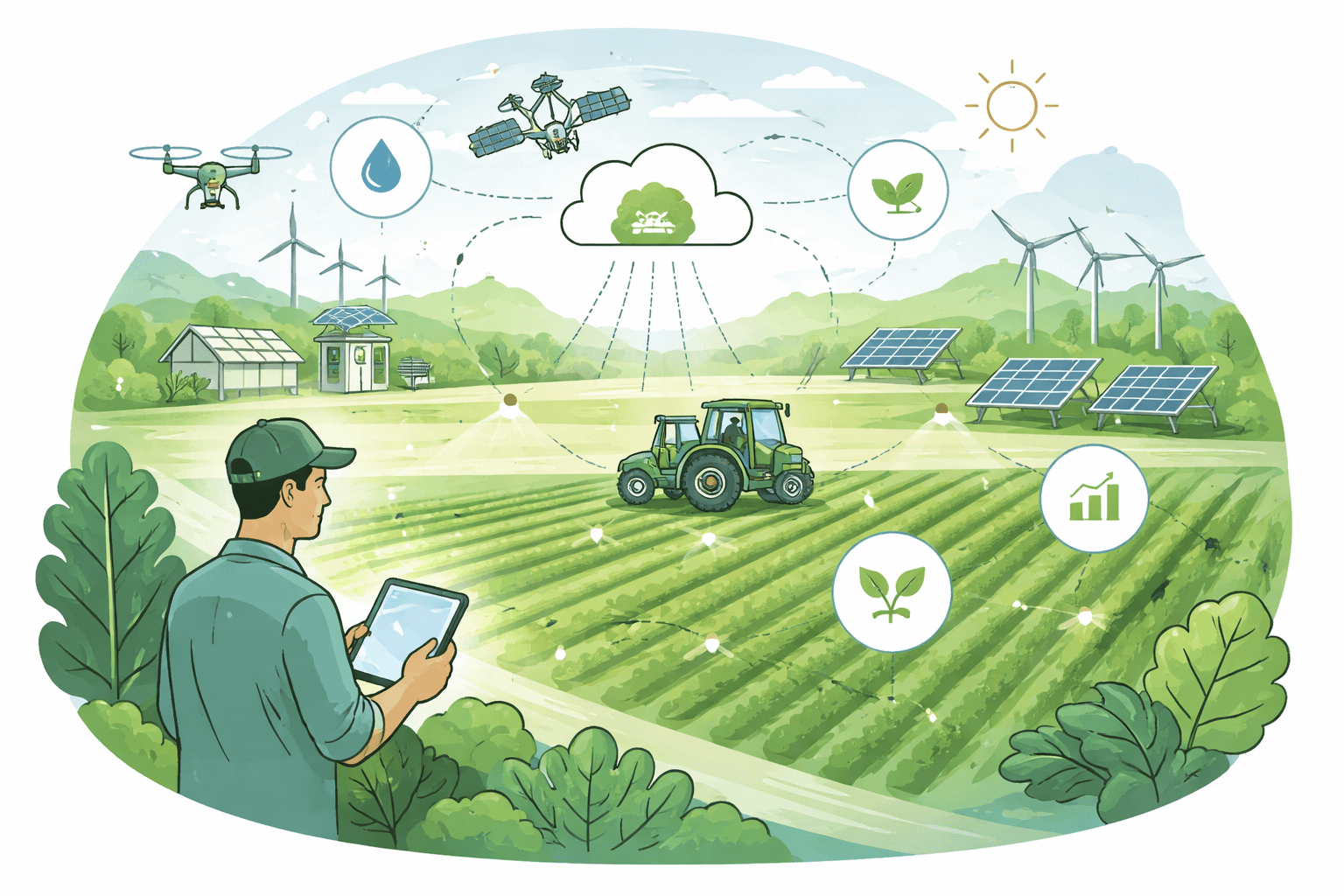
Agriculture is in the middle of a data revolution. Across major crops, GPS guidance and yield monitors are now used on roughly half to two‑thirds of U.S. acres, while variable‑rate input application has reached one in five to one in three fields, according to multiple USDA Economic Research Service (ERS) analyses of 2016–2021 survey data. Those tools are the backbone of precision agriculture and sustainability strategies that can cut irrigation water 20–30%, reduce nitrogen and pesticide use 10–30%, and trim fuel consumption by around 10%, while maintaining or even boosting yields in many systems. For growers navigating tight margins, water scarcity, and climate volatility, that math matters.
This guide explains how precision agriculture works, the technologies that make it tick, the sustainability payoffs, the practical challenges, and where the next wave of climate‑smart farming is heading.
What is precision agriculture?
Precision agriculture is a data‑driven approach to farming that uses sensors, positioning, and analytics to apply the right input, at the right rate, at the right time, and in the right place. Instead of treating a field as uniform, precision systems manage variability within fields—soil texture, organic matter, elevation, pest pressure, and plant vigor—at sub‑field resolution.
Precision Agriculture for Sustainability and Environmental Protection (Earthscan Food and Agriculture): Oliver, Margaret, Bishop, Thomas, Marchant, Ben
Margaret Oliver is a <strong>Visiting Professor in the Department of Soil Science at the University of Reading, UK</strong>, and was for several years editor of the Journal of Precision Agriculture.
Check Price on AmazonKey idea: variability. A 100‑acre field typically contains zones that differ in water‑holding capacity, fertility, and yield potential. Precision methods map those differences and target inputs accordingly, reducing waste while protecting yields. The result is lower input costs, less runoff and emissions, and better long‑term soil function.
Precision agriculture and sustainability go hand in hand: cutting over‑application reduces environmental impact, while maintaining plant nutrition and water balance safeguards productivity.
Core technologies that power precision farming
Positioning and guidance
- GPS/GLONASS and real‑time kinematic (RTK) correction: RTK uses a local base station (or network) to correct GPS signals for 1–2 centimeter accuracy. That precision enables auto‑steer, controlled‑traffic lanes, and exact seed and input placement.
- Auto‑steer and section control: Software prevents overlap and skips on planters and sprayers by turning sections on/off automatically at headlands and field boundaries.
Sensing and imagery
- Yield monitors: Combine‑mounted sensors record grain flow and moisture to generate geo‑referenced yield maps at harvest. These maps anchor variable‑rate prescriptions the following season.
- Soil sensors and sampling: Grid or zone soil sampling (often 1–5 hectares per sample) characterizes pH, phosphorus, potassium, and organic matter. In‑situ probes measure soil moisture, salinity, and temperature.
- Multispectral drone and satellite imagery: Cameras capture reflectance in visible and near‑infrared bands to calculate indices such as NDVI (Normalized Difference Vegetation Index), a proxy for plant vigor and canopy density. Modern satellites (e.g., ESA’s Sentinel‑2 at 10 m resolution with 5‑day revisit) and commercial constellations offer frequent, cloud‑tolerant views; drones add ultra‑high‑resolution data when timing is critical. See our overview of aerial tools in Drone Technology for Conservation: How Aerial Tools Are Helping Protect Nature.
- Canopy and weather sensors: In‑field weather stations and leaf‑wetness sensors feed disease risk models; thermal cameras and evapotranspiration (ET) models estimate crop water use.

DJI Mavic 3, Drone with 4/3 CMOS Hasselblad Camera, 5.1K Video, Omnidirectional Obstacle Sensing, 46 Mins Flight, Advanced Auto Return, 15km Video Transmission, FAA Remote ID Compliant, Gray : Toys & Games
Buy DJI Mavic 3, Drone with <strong>4/3 CMOS Hasselblad Camera, 5.1K Video, Omnidirectional Obstacle Sensing, 46 Mins Flight, Advanced Auto Return, 15km Video Transmission, FAA Remote ID Compliant, Gr
Check Price on AmazonVariable‑rate and automation
- Variable‑rate technology (VRT): Controllers adjust seed, fertilizer, lime, or pesticide rates on the move using prescription maps. Two common strategies are zone management (management units based on soil/terrain) and grid management (uniform grids with interpolation).
- Variable‑rate irrigation (VRI): Sprinkler systems (e.g., center pivots) pulse or vary flow by zone to match soil and topography.
- Machine vision and spot spraying: Cameras plus on‑board AI identify weeds or disease, turning nozzles on only where needed.
Data platforms and analytics
- Farm management software: Platforms integrate machine logs, imagery, soil tests, and weather data, then generate prescriptions and track operations. Increasingly, decision support tools use machine learning to recommend nitrogen side‑dress timing, irrigation sets, or fungicide sprays based on probabilistic risk.
- Connectivity and edge computing: Low‑power wide‑area networks (LPWAN), cellular, and on‑machine processors push analytics closer to the field, cutting latency and data costs.
By the numbers: performance and adoption
- Adoption: GPS guidance on roughly 50–70% of U.S. corn, soybean, and wheat acres; yield monitors near 40–60%; VRT fertilizer on about 20–30% of acres across major crops (USDA ERS analyses of ARMS surveys, 2016–2021).
- Water: Soil‑moisture‑guided irrigation and VRI routinely reduce water use 8–30% with neutral or positive yield effects in field studies by USDA’s Agricultural Research Service (ARS) and land‑grant universities.
- Nutrients: Precision nitrogen management (sensors + VRT) often cuts N rates 10–20% with similar yields in peer‑reviewed meta‑analyses; some site‑specific systems report larger savings on variable fields.
- Pesticides: Machine‑vision spot spraying has reduced herbicide volumes 20–60% in university and extension trials while maintaining control.
- Fuel: Auto‑steer and controlled‑traffic lanes reduce overlap and soft‑soil passes, saving about 6–15% in fuel use (USDA NRCS and university extension estimates).
- Yield: Integrated precision systems commonly deliver 3–8% yield gains by matching inputs to yield potential zones (USDA ERS syntheses and multi‑year trials).
- Emissions: IPCC’s default factor estimates about 1% of applied N is emitted as N₂O; cutting N 10–20% reduces direct N₂O in roughly the same proportion, with additional CO₂ savings from lower diesel use.
How precision agriculture and sustainability reinforce each other
Lower water use and improved drought resilience
- Irrigation scheduling uses soil‑moisture probes, ET models, and weather forecasts to time irrigations when plants need it—not based on calendar days. Studies by USDA ARS and state extension programs consistently show 10–25% water savings with no yield penalty.
- VRI prevents overwatering on low‑lying or fine‑textured zones and prioritizes sandy or elevated zones that dry faster. Besides saving water, right‑sizing irrigation reduces leaching of nitrates.
Why it matters: Agriculture accounts for about 70% of global freshwater withdrawals (FAO). Precision water management scales conservation without asking for yield sacrifices.
Reduced fertilizer losses and cleaner waterways
- Soil pH and nutrient maps guide lime and P/K applications, preventing over‑application on already fertile zones and correcting deficiencies where they matter.
- Nitrogen timing and rate optimization—using crop models, canopy sensors, and historical yield data—curb excess N that would otherwise volatilize (NH₃), leach (NO₃⁻), or emit as nitrous oxide (N₂O). Meta‑studies report 10–20% N savings with neutral yields, and reductions in nitrate runoff and leaching in the 10–30% range depending on soil and rainfall.

Trimble Navigation Nomad 900LE Rugged Handheld Computer, Numeric Keypad, 806MHz Processor, 128MB RAM/1GB Flash, 5200mAh Lithium-ion Battery NMDAJY-111-00 by Trimble Navigation : Electronics
View on AmazonWhy it matters: N₂O has ~273 times the 100‑year global warming potential of CO₂ (IPCC AR6), and nutrient runoff drives harmful algal blooms and hypoxia. Precision management tackles both.
Better soil health and less compaction
- Controlled‑traffic farming (CTF) keeps machinery on permanent lanes guided by RTK, shrinking the trafficked area of a field from ~80% to ~15–20% in some systems. Trials from university and government programs in Australia, Europe, and the U.S. show improved infiltration, reduced bulk density, and 2–16% yield bumps in responsive crops.
- Variable residue and cover‑crop strategies informed by yield and soil maps target soil‑building where it’s needed most.
For a deeper dive into building resilient soils, see our guide to Soil Health and Regenerative Agriculture: A Practical Guide to Restoring Living Soil.
Lower fuel consumption and greenhouse gas emissions
- Auto‑steer and section control limit duplicate passes and idling at headlands, trimming diesel use by roughly 10% in many operations. On large equipment fleets, that adds up quickly.
- Input reductions cascade into lower upstream emissions from fertilizer manufacturing (energy‑intensive ammonia synthesis) and pesticide production.
Targeted pesticide use and resistance management
- Zone‑specific scouting aided by high‑resolution imagery focuses sprays where pest pressure is real. Machine‑vision sprayers only treat green weeds against bare soil, cutting volumes and slowing resistance selection by avoiding blanket exposure.
Together, these effects illustrate how precision agriculture and sustainability outcomes are aligned: fewer inputs per bushel, less environmental loading, and stronger agronomic foundations.
Practical challenges and tradeoffs
Precision systems aren’t plug‑and‑play. Common hurdles include:
- Upfront costs and ROI: Auto‑steer and section control are often cost‑effective within 1–3 years on medium‑to‑large farms due to savings and yield stability, but variable‑rate retrofits, sensors, and analytics subscriptions add to capital and operating costs. Smaller farms face longer payback periods unless equipment is shared through cooperatives or service providers.
- Data quality and interoperability: Poorly calibrated sensors, inconsistent sampling zones, or mixing proprietary formats can erode gains. Open data standards and careful calibration are essential.
- Connectivity: Many rural regions lack reliable cellular coverage. Edge computing (processing data on the machine) and low‑bandwidth sync strategies help, but infrastructure gaps persist.
- Training and workflow change: Turning data into decisions requires agronomy knowledge and time. Extension programs and independent consultants can bridge skill gaps, but ongoing training is needed as tools evolve.
- Data privacy and ownership: Machine logs, imagery, and soil data have commercial value. Clear contracts specifying who owns and can resell or aggregate data protect farmers’ interests. Several producer groups advocate for “privacy by default” and opt‑in data sharing.
- Access for smallholders: In low‑ and middle‑income countries, high‑resolution satellite services, shared drone flights, pay‑per‑use VRT, and smartphone‑based decision tools are lowering barriers, but equitable access and agronomic localization remain policy priorities (FAO and World Bank reports).
- Integration with existing practices: Precision tools work best layered onto good agronomy—crop rotation, cover crops, drainage management, and integrated pest management (IPM). Technology can’t compensate for systemic soil or drainage problems.
For context on how sensors, AI, and renewables are reshaping conservation workflows beyond farms, see How Technology Aids Conservation: Sensors, AI, and Renewable Solutions.
Real‑world outcomes: what the data shows
- Corn belt nitrogen: Studies using canopy sensors and historical yield zones have reported 10–18% less N applied with unchanged yield, translating to lower N₂O emissions and improved partial factor productivity of nitrogen (kg grain per kg N).
- Western U.S. irrigation: USDA ARS trials on center pivots found VRI plus soil moisture probes reduced water use 15–25% and energy use for pumping by 10–20%, with yield maintained or improved on variable soils.
- Herbicide spot spraying: Field trials by universities and government agencies in Australia and North America showed 20–60% reductions in herbicide active ingredient with no drop in control when using green‑on‑brown detection in fallow or pre‑emerge passes.
- Controlled traffic and compaction: Long‑term CTF sites report higher infiltration rates and lower fuel burn due to firmer traffic lanes, with yield benefits most pronounced in root‑sensitive crops.
These outcomes are typical when precision tools are coupled with robust agronomy and calibrated to local variability. They also demonstrate why many climate‑smart agriculture programs now subsidize soil moisture sensors, VRT, and nutrient management planning: environmental benefits align with farm economics.
How it works under the hood: from data to decisions
Map variability. Start with elevation (from RTK or LiDAR), historic yield maps, and soil sampling by management zone. Add imagery to capture in‑season vigor differences.
Build prescriptions. Use agronomic models and local research to translate maps into seed and input rates. Example: higher seeding in high‑yield potential zones; lower N where organic matter and residual N are high; lime only where pH is below target.
Execute with feedback. Apply prescriptions with VRT controllers and log as‑applied data. After harvest, compare yield to prescriptions to refine zones and rates. This “measure, act, learn” loop is central to sustained gains.
Practical steps to get started (and keep improving)
- Nail guidance and section control first. Overlap elimination gives fast savings in fuel and inputs.
- Calibrate everything. Flow meters, spreaders, and yield monitors need routine checks; miscalibration can erase benefits.
- Start with zones, not grids, if budgets are tight. Use soil maps, topography, and historic yield to delineate 3–6 zones per field, then refine over time.
- Add soil moisture monitoring where water is limiting. Even two to three probes in representative zones can sharpen irrigation timing.
- Pilot spot spraying or variable fungicide. Try on fields with known variability to quantify savings before scaling.
- Close the loop with post‑harvest analysis. Use partial budget analysis to attribute savings and yield changes to specific practices.
Where precision agriculture is heading
- Cheaper, better imagery: More frequent, higher‑resolution satellite revisits and radar that sees through clouds will make in‑season scouting more reliable. NASA’s SMAP and ESA’s Sentinel missions already inform soil moisture and vegetation status; commercial constellations add daily field‑level views.
- On‑machine AI and robotics: Edge processors now enable real‑time weed identification and robotic in‑row cultivation, cutting herbicides further. Autonomous implements will expand controlled traffic and reduce labor constraints.
- Whole‑farm optimization: Platforms will integrate carbon intensity, biodiversity, and water metrics alongside yield and cost, supporting sustainability reporting and eco‑labeling.
- Climate‑smart stacking: Precision tools paired with cover crops, reduced tillage, improved drainage, and heat‑tolerant varieties can stabilize yields under extreme weather. Carbon market protocols increasingly recognize measurement‑based nitrogen management.
- Power and land co‑design: In dry regions, co‑locating solar with crops (agrivoltaics) can moderate microclimates and reduce irrigation needs while generating energy. See Agrivoltaics Solar Farming: How Farms and Solar Power Can Share the Same Land for emerging models.
Policy and market implications
- Incentives that reward verified outcomes work. Cost‑share for soil moisture sensors, VRT controllers, and nutrient management planning can unlock adoption, especially for small and mid‑size farms.
- Data governance frameworks are needed. Clear, farmer‑centric data ownership and portability rules reduce adoption risk.
- Public infrastructure pays dividends. Rural broadband and open satellite data (e.g., Copernicus) are foundational public goods that make private innovation useful on the ground.
- Extension and technical assistance remain critical. Precision tools are leverage, not replacements, for agronomy. Investing in people—advisors, educators, and peer learning—multiplies technology’s benefits.
Why precision agriculture and sustainability belong in the same sentence
The core promise is straightforward: maintain or increase yields while lowering inputs and environmental impacts per bushel. Evidence from USDA ERS adoption studies, ARS field trials, and peer‑reviewed analyses shows that promise is achievable at scale when data quality, calibration, and agronomy are in place. As imagery, sensors, and analytics improve—and as policies reward measured outcomes—precision agriculture will be a central pillar of climate‑smart, resource‑efficient food systems.
For related technology pathways shaping conservation beyond the farm gate, explore Using Technology for Environmental Protection: Tools, Impacts, and Practical Guidance.
Recommended Products
Precision Agriculture for Sustainability and Environmental Protection (Earthscan Food and Agriculture): Oliver, Margaret, Bishop, Thomas, Marchant, Ben
Margaret Oliver is a <strong>Visiting Professor in the Department of Soil Science at the University of Reading, UK</strong>, and was for several years editor of the Journal of Precision Agriculture.
DJI Mavic 3, Drone with 4/3 CMOS Hasselblad Camera, 5.1K Video, Omnidirectional Obstacle Sensing, 46 Mins Flight, Advanced Auto Return, 15km Video Transmission, FAA Remote ID Compliant, Gray : Toys & Games
Buy DJI Mavic 3, Drone with <strong>4/3 CMOS Hasselblad Camera, 5.1K Video, Omnidirectional Obstacle Sensing, 46 Mins Flight, Advanced Auto Return, 15km Video Transmission, FAA Remote ID Compliant, Gr
Trimble Navigation Nomad 900LE Rugged Handheld Computer, Numeric Keypad, 806MHz Processor, 128MB RAM/1GB Flash, 5200mAh Lithium-ion Battery NMDAJY-111-00 by Trimble Navigation : Electronics
Amazon.com: Trimble Navigation Nomad 900LE Rugged Handheld Computer, Numeric Keypad, 806MHz Processor, 128MB RAM/1GB Flash, 5200mAh Lithium-ion Battery NMDAJY-111-00 by Trimble Navigation : Electronic
More in AI & Technology
- Practical Sustainable Gardening: Greener, Resilient Practices for Every Garden
- Agrivoltaics Solar Farming: How Farms and Solar Power Can Share the Same Land
- How Technology Aids Conservation: Sensors, AI, and Renewable Solutions
- Using Technology for Environmental Protection: Tools, Impacts, and Practical Guidance