Deforestation Explained: Causes, Impacts, and Solutions
Deforestation is one of the most measurable—and solvable—drivers of climate change and biodiversity loss. Global forest area stands at about 4.06 billion hectares (31% of Earth’s land), but we continue to convert forests to other land uses, primarily agriculture. A 2021 FAO remote-sensing study found that 90% of deforestation from 1990–2020 was due to agricultural expansion—about half for cropland and half for pasture. In 2023, primary tropical forest loss fell about 9% to roughly 3.7 million hectares, driven by reductions in Brazil, even as losses rose in Bolivia (WRI/Global Forest Watch, 2024). Understanding deforestation—its causes, impacts, and solutions—is essential to meeting climate and nature goals.
What is deforestation? Definition, types, and how it’s measured
Deforestation is the permanent conversion of forest to another land use, such as cropland, pasture, mining, or settlements. It’s distinct from:

Why Forests? Why Now?: The Science, Economics, and Politics of Tropical Forests and Climate Change: Seymour, Frances, Busch, Jonah
Seymour & Busch do a marvelous job of <strong>explaining what's causing deforestation, why it's so pernicious and what can be done to stop it. With a compelling mix of case studies and d
Check Price on Amazon- Forest degradation: the reduction of a forest’s ecological function (e.g., selective logging or fires) without a land-use change.
- Temporary forest loss: such as harvesting in managed plantations where the area remains designated as forest and regrows.
- Tree cover loss: any loss of canopy cover, which can include plantations and fire scars—useful for monitoring but not synonymous with deforestation.
“Forest” itself has formal definitions in national inventories and in UN climate reporting, typically combining minimum tree height, canopy cover, and area thresholds (for example, trees taller than 5 meters, canopy cover above 10–30%, and a minimum area of 0.5–1 hectare).
Types of deforestation
- Clear-cut conversion: wholesale removal of natural forest to cropland or pasture.
- Gradual encroachment: smallholder expansion and shifting cultivation leading to cumulative conversion.
- Peatland clearing and drainage: especially in Southeast Asia, which collapses carbon-rich soils and drives intense fires.
- Frontier expansion along access corridors: deforestation spreading from roads, logging tracts, and new infrastructure.
How deforestation is measured
- National forest inventories: countries report forest area change to the FAO (Forest Resources Assessment, FRA) and to the UNFCCC under REDD+.
- Satellite-based monitoring: Landsat, Sentinel, and Planet imagery power near-real-time alerts (e.g., GLAD and RADD), which detect canopy loss at 10–30 meter resolution. Analysts combine alerts with land-use data to distinguish deforestation from other loss.
- Remote-sensing surveys: FAO’s 2021 global remote sensing survey harmonized sample-based analysis across decades, confirming agriculture as the dominant driver.
- Jurisdictional systems: Brazil’s PRODES (annual deforestation polygons) and DETER (near-real-time alerts) are examples of public monitoring that guide enforcement.
Global extent and recent trends—key statistics and hotspots
- Global forest area: ~4.06 billion hectares (FAO FRA 2020), down by about 178 million hectares since 1990. The net loss rate slowed from ~7.8 million ha/year in the 1990s to ~4.7 million ha/year during 2010–2020 (FAO).
- Tropical primary forests: In 2023, primary tropical forest loss declined about 9% to ~3.7 million ha compared to 2022, with sharp reductions in Brazil offset by increases in Bolivia (WRI/Global Forest Watch, 2024). Primary forests are the most carbon- and biodiversity-dense.
- Land-use change emissions: Global Carbon Project estimates land-use change emitted roughly 4.1 Gt CO2 in 2022—about 10% of total CO2 emissions—largely from tropical deforestation and peatland drainage.
Hotspots
- Amazon Basin: Brazil historically accounts for the largest share of tropical forest loss. After surges in 2019–2022, deforestation fell substantially in 2023 under renewed enforcement and policy shifts, though conversion in the adjacent Cerrado savanna rose. Cattle ranching dominates cleared land in the Brazilian Amazon—estimates suggest 70–80% of deforested land becomes pasture (MapBiomas/IPAM).
- Congo Basin (Central Africa): The Democratic Republic of the Congo (DRC) has sustained high loss, primarily smallholder agriculture and fuelwood/charcoal. Population and energy access dynamics are central here.
- Southeast Asia: Indonesia’s primary forest loss has declined markedly since 2016, linked to peatland protection, moratoria, and private-sector no-deforestation commitments. Malaysia also shows long-term declines, though peat and plantation expansion pressures persist.
By the numbers
- 4.06 billion ha: Global forest area (FAO FRA 2020)
- 90%: Share of deforestation caused by agricultural expansion, 1990–2020 (FAO Remote Sensing, 2021)
- ~4.1 Gt CO2/year: 2022 land-use change emissions (Global Carbon Project, 2023)
- 80%: Share of terrestrial biodiversity found in forests (UNEP/FAO)
- ~3.7 million ha: Primary tropical forest loss in 2023, down ~9% vs. 2022 (WRI/Global Forest Watch, 2024)
Primary drivers: agriculture, cattle ranching, logging, mining, infrastructure, and fires
- Commercial and subsistence agriculture: FAO’s global remote-sensing study attributes about half of deforestation to cropland expansion (commodities like soy, oil palm, cocoa) and about half to pasture for cattle. In the Amazon, pasture is the dominant land use following clearing.
- Cattle ranching: Low-intensity grazing often follows speculative clearing; weak land tenure can reward illegal occupation and conversion. Supply-chain traceability is challenging given indirect suppliers.
- Logging (legal and illegal): Selective logging degrades forests and opens access roads, increasing fire risk and subsequent conversion. Where governance is weak, illegal logging can be a precursor to permanent deforestation.
- Mining and extractives: Industrial and artisanal mining drive localized deforestation, biodiversity loss, and pollution (e.g., mercury in the Amazon). Roads, powerlines, and worker settlements amplify indirect impacts.
- Infrastructure: New highways, dams, and rail create deforestation “fishbones” branching from the main corridor. Strategic environmental assessments and avoidance can reduce these ripple effects.
- Fire: In moist tropical forests, fire is typically human-induced and used to clear land; droughts and El Niño intensify severity. Peat fires in Indonesia (notably 2015) released hundreds of megatonnes of CO2, caused hazardous air pollution, and devastated peat ecosystems.
Environmental and social impacts: carbon emissions, biodiversity loss, soil degradation, water cycles, indigenous communities
- Carbon emissions and climate feedbacks: When forests are cleared, stored carbon in biomass and soils is released as CO2. Tropical deforestation and peatland drainage are among the largest land-use emissions sources. Forest loss also reduces evapotranspiration and cloud formation, reinforcing regional drying.
- Biodiversity loss: Forests house roughly 80% of terrestrial biodiversity. Fragmentation and edge effects reduce species richness, facilitate invasive species, and impair ecosystem functions like pollination and pest control. Primary forests are irreplaceable on human timescales for endemic species.
- Soil degradation: Removal of canopy and litter exposes soils to erosion, nutrient leaching, and compaction. On steep slopes, landslide risk increases; on peat, oxidation leads to subsidence and long-term CO2 emissions.
- Water cycles and rainfall: Large forests recycle moisture and generate “flying rivers.” In the Amazon, studies link deforestation to declines in regional rainfall and longer dry seasons, with downwind impacts on agriculture and hydropower.
- Indigenous Peoples and local communities: Secured land rights consistently correlate with lower deforestation. Rigorous evaluations show strong protective effects—for example, titling of Indigenous land in Peru reduced deforestation by roughly 75% within two years (Blackman et al., PNAS, 2017). In Brazil, Indigenous Territories exhibit far lower loss than surrounding lands when enforcement and rights are respected.
- Health and livelihoods: Fire and haze episodes cause respiratory illness and economic losses. Deforestation can undermine food and water security for rural communities dependent on forest ecosystem services.

IQAir AirVisual Air Quality Monitor Bundle, Swiss-Designed Indoor & Outdoor Sensors, Professional Grade Real-Time Air Quality Tracking
View on AmazonPrevention and mitigation strategies: protected areas, sustainable agriculture, supply-chain policies, REDD+ and carbon finance
- Protected and conserved areas: Expanding and effectively managing protected areas reduces deforestation, especially when budgets, rangers, and community co-management are in place. Integration with Indigenous and community-conserved areas boosts durability. For practical approaches to design and stewardship, see our guide to Forest Conservation Strategies: Practical, Science-Based Approaches to Protect, Restore, and Manage.
- Sustainable intensification and agroforestry: Increasing yields on existing farmland (with soil health, extension services, and finance) reduces pressure to clear forests. Agroforestry systems for cocoa and coffee maintain canopy cover and buffer biodiversity.
- Zero-deforestation supply chains: The 2006 Amazon Soy Moratorium helped decouple soy expansion from deforestation in the Brazilian Amazon—direct conversion for soy fell from around 30% of expansion pre-moratorium to near 1–2% within a decade (Gibbs et al., 2015). In palm oil, “No Deforestation, No Peat, No Exploitation” (NDPE) policies now cover most global refining capacity, with evidence of reduced forest conversion in Indonesia. Credible certification (RSPO for palm, FSC/PEFC for timber, Rainforest Alliance for cocoa/coffee) complements public enforcement.
- Jurisdictional approaches: Aligning companies, communities, and governments at the province or state scale can reduce leakage and harmonize incentives, enabling results-based finance and shared metrics.
- Land tenure and enforcement: Clarifying land rights and strengthening environmental agencies deter speculative clearing. Brazil’s use of satellite monitoring linked to fines and embargoes illustrates how detection plus deterrence can shift behavior.
- Carbon finance and REDD+: Under the Paris Agreement (Article 5), countries can receive results-based payments for reducing emissions from deforestation and forest degradation (REDD+). High-integrity jurisdictional programs paired with robust monitoring, reporting, and verification (MRV) can unlock finance while safeguarding biodiversity and communities. Independent standards and risk buffers are critical to environmental integrity.
- Restoration and rewilding: Where deforestation has occurred, assisted natural regeneration, enrichment planting, and rewilding can recover carbon and habitat. For restoration concepts and trade-offs, see What Is Rewilding? How Ecosystem Restoration Is Changing Conservation.
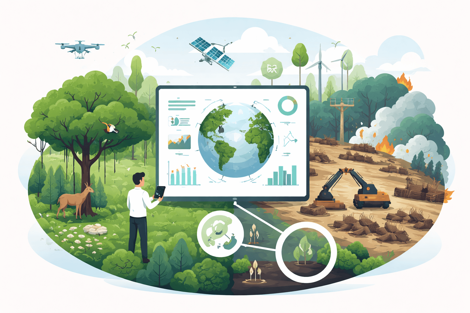
The role of technology and renewable energy: satellite monitoring, AI for detection, sustainable bioenergy vs. impacts
- Satellite monitoring at scale: Open- and commercial-constellation satellites (Landsat 8/9, Sentinel-1/2, Planet) enable frequent coverage. Near-real-time alerts (GLAD optical; RADD radar) detect loss even under cloud cover, guiding rapid response and enabling due diligence.
- AI for detection and enforcement: Machine learning classifies land cover, flags anomalies, and predicts risk along new road corridors. Acoustic AI can detect chainsaw signatures, while computer vision supports automated compliance checks. Explore practical applications and ethics in Using AI for Habitat Conservation: Practical Applications, Data Needs, and Ethical Implementation and a broader survey in How Technology Aids Conservation: Sensors, AI, and Renewable Solutions.
- Open data ecosystems: Public dashboards (e.g., GFW, Brazil’s PRODES/DETER), community mapping, and participatory MRV make monitoring transparent and actionable.
- Clean cooking and energy access: About 2.3 billion people rely on traditional biomass for cooking (IEA). Expanding access to electricity, LPG as a transition fuel, and efficient stoves reduces pressure on woodfuel-driven degradation—particularly around rapidly growing cities.
- Bioenergy, done right: Using forest residues, mill byproducts, or agricultural wastes for bioenergy can avoid additional land conversion. Policies should avoid incentivizing harvest of whole trees from natural forests for energy, which risks carbon debt and biodiversity harm. Advanced biofuels from waste streams and sustainable residues minimize land-use impacts.
- Renewable siting: Wind, solar, and transmission should be sited to avoid high-carbon and high-biodiversity forests, using spatial planning and mitigation hierarchies. Early screening and community engagement reduce conflict and habitat fragmentation. For practical conservation planning in energy contexts, see Protecting Wildlife Habitats: A Practical Guide to Conservation, Technology, and Action.

EcoZoom Rocket Stove – Heavy Duty Dual Fuel (Wood & Charcoal) Portable Camping & Emergency Stove, Insulated Body, Refractory Linings, Cast-Iron Cookware Compatible
View on AmazonWhat governments, businesses, and individuals can do
Governments
- Enact and enforce forest laws: Fund environmental agencies, prosecutors, and courts. Use satellite alerts to target inspections and embargo illegally cleared land.
- Secure land and resource rights: Recognize Indigenous and community tenure; titling has strong, cost-effective conservation returns.
- Align agricultural policy: Tie rural credit and subsidies to deforestation-free production; invest in extension, soil health, and yield increases on existing farmland.
- Implement trade and due diligence: The EU Deforestation Regulation (EUDR, 2023) requires imports of cattle, cocoa, coffee, palm oil, rubber, soy, and timber to be deforestation-free, with geolocation traceability. Similar due-diligence frameworks in the UK and proposed in the U.S. can harmonize global expectations.
- Plan infrastructure to avoid forests: Apply strategic environmental assessments, route optimization, and no-go zones for intact forests and peatlands.
Businesses
- Set time-bound, verified no-deforestation commitments: Cover all suppliers, including indirect ones in cattle and cocoa. Use geospatial monitoring of farms, ranches, and mills.
- Traceability and disclosure: Map supply sheds; use mass-balance or segregated certified supply where feasible; publish progress and non-compliance protocols.
- Engage producers: Provide long-term contracts, price premiums, and technical assistance for smallholders transitioning to deforestation-free practices.
- Leverage jurisdictional partnerships: Support government-led monitoring and enforcement; co-finance restoration where risks concentrate.
- Address leakage: Expand policies beyond single commodities to all major deforestation drivers in a region.
Individuals and civil society
- Adjust diets and reduce waste: Cutting beef consumption in high-income countries reduces pasture-driven deforestation; minimizing food waste lowers overall land demand.
- Choose certified products: Look for RSPO (palm), FSC/PEFC (wood and paper), Rainforest Alliance (cocoa/coffee), and company-level forest policies.
- Support frontline defenders: Donate to credible Indigenous organizations and local NGOs that monitor and protect forests. For evidence on what works and how to scale, see Beyond Intentions: A Data‑Driven Analysis of the Impact of Conservation Efforts.
- Advocate: Push for strong due-diligence laws and enforcement; engage retailers and brands to adopt and implement forest-positive sourcing.
- Get involved locally: Urban tree-planting, watershed protection, and habitat creation build momentum and skills—see How Technology Aids Conservation: Sensors, AI, and Renewable Solutions for tools you can leverage.
Data sources, further reading, and resources (datasets, NGOs, monitoring tools)
Core datasets and platforms
- FAO Forest Resources Assessment (FRA) and FAO Remote Sensing Survey (2021)
- Global Forest Watch (WRI): GLAD and RADD alerts, primary forest loss, fire and peatland layers
- Brazil PRODES/DETER (INPE): annual deforestation mapping and near-real-time alerts
- MapBiomas (Brazil): land-cover change and post-deforestation land use
- Global Carbon Project: annual CO2 budgets, including land-use change emissions
- UNFCCC REDD+ Info Hub: country results and payments
- NASA GEDI: global canopy height and structure; ESA Climate Change Initiative land cover
Key reports and science
- IPCC AR6 WGIII: AFOLU mitigation pathways and drivers of land-use emissions
- FAO/UNEP State of the World’s Forests (SOFO): drivers, finance, and policies
- Peer-reviewed studies on the Amazon Soy Moratorium (e.g., Gibbs et al., 2015) and Indigenous land titling impacts (Blackman et al., PNAS, 2017)
Implementers and coalitions
- Indigenous and community organizations; national and local NGOs in tropical forest countries
- Certification bodies: RSPO, FSC, PEFC, Rainforest Alliance
- Accountability Framework initiative; Consumer Goods Forum’s Forest Positive Coalition
Monitoring and decision-support tools
- Trase: supply-chain mapping and deforestation risk by company/region
- Land & Carbon Lab (WRI): carbon stocks, fluxes, and land cover change
- Fire and air-quality systems: FIRMS (NASA), local and regional haze monitors
Where the field is heading
- Combining radar and optical satellites will continue to lower detection latency and false positives. AI will increasingly triage alerts and predict risk, while community-based monitoring integrates local knowledge and legal action.
- Jurisdictional REDD+ programs with robust safeguards are scaling, with results-based payments tied to high-integrity baselines and independent verification.
- Trade regulations like the EUDR are shifting market norms toward geolocated, deforestation-free supply chains—raising the bar on traceability while requiring support for smallholders to comply.
- Climate-smart agriculture and restoration finance are moving from pilots to portfolios, with blended finance de-risking producer transitions and emphasizing measurable outcomes for carbon, biodiversity, and livelihoods.
Deforestation is not inevitable. The tools to bend the curve—transparent monitoring, rights-based conservation, deforestation-free markets, restoration at scale, and clean energy access—are here. The next gains will come from aligning them in the places and supply chains where they matter most, measuring what works, and sustaining political and financial commitment over decades.
Recommended Products
Why Forests? Why Now?: The Science, Economics, and Politics of Tropical Forests and Climate Change: Seymour, Frances, Busch, Jonah
Seymour & Busch do a marvelous job of <strong>explaining what's causing deforestation, why it's so pernicious and what can be done to stop it. With a compelling mix of case studies and d
IQAir AirVisual Air Quality Monitor Bundle, Swiss-Designed Indoor & Outdoor Sensors, Professional Grade Real-Time Air Quality Tracking
The AirVisual Outdoor air quality monitor <strong>can measure up to 8 environmental parameters including PM1, PM2.5, PM10, CO2 (optional sensor module required), AQI, temperature, humidity, and atmosp
EcoZoom Rocket Stove – Heavy Duty Dual Fuel (Wood & Charcoal) Portable Camping & Emergency Stove, Insulated Body, Refractory Linings, Cast-Iron Cookware Compatible
Exercise caution when using large pots and always use a flat, stable surface. We don't recommend it. Versa is a rocket stove design which means it is <strong>optimized for side fuel entry using l
More in Sustainability Policy
- Forest Conservation Strategies: Practical, Science-Based Approaches to Protect, Restore, and Manage
- How Satellite Monitoring Helps Track Deforestation in Real Time
- Land Conservation Best Practices: Planning, Protection, Stewardship, and Long-Term Management
- How Conservation Changes Ecosystems: Mechanisms, Evidence, Measurement, and Policy Trade‑offs